0340L-SATURDAY OUTLOOK FROM GARFIELD COUNTY EMERGENCY MANAGEMENT-9/4/21
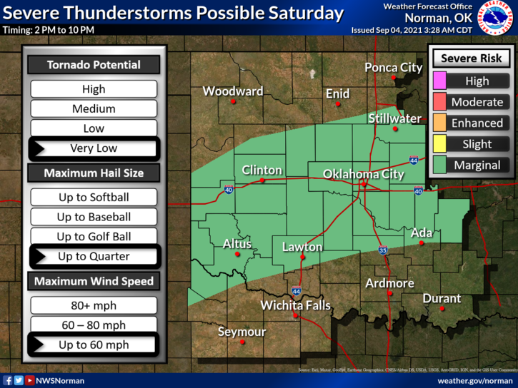
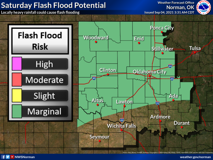
1- MARGINAL RISK for severe weather today. The front is just north of us at 0320L and creeping very slowly to the south, This will keep us in that area of concern through the day. If storms do occur, 60 mph winds and quarter size hail are possible. If storms pulse up and down as they did yesterday, higher winds are possible. Kremlin sustained damage when either a downburst or collapsing storm occurred causing winds upwards of an estimated 70 mph. Large branches were broken and fences were knocked down. They also received just over 2 inches of rainfall yesterday afternoon. Haven’t received any other damage reports yet. Hillsdale received 1.6 inches of rainfall yesterday and no damage was reported.
2- Overall, we’ll be ok, BUT keep an eye to the sky if you have outdoor activities going on and always remember that if you can hear thunder, you CAN be hit by lightning.
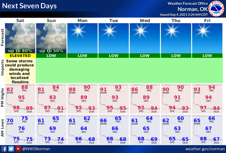
3- Here is your forecast from the NWS/NORMAN;
Saturday-Mostly cloudy. A chance of showers and a slight chance of thunderstorms in the morning, then thunderstorms likely in the afternoon. Some thunderstorms may produce gusty winds and heavy rainfall in the afternoon. Highs in the lower 90s. West winds around 10 mph shifting to the north in the afternoon. Chance of precipitation 70 percent.
Saturday Night-Partly cloudy. A chance of showers and a slight chance of thunderstorms. Some thunderstorms may produce gusty winds and heavy rainfall in the evening. Lows in the mid-60s. Northeast winds around 10 mph. Chance of precipitation 50 percent.
FINALLY; Download our GARFIELD COUNTY EM app. NWS warnings and advisories automatically come through along with info from us. It’s loaded with information and you never know, it just might save your life!
HAVE A GOOD DAY!!
MIKE