0340L-FRIDAY OUTLOOK FROM GARFIELD COUNTY EMERGENCY MANAGEMENT-9/3/21
GARFIELD COUNTY EM is our public safety app. Download it today and stay safe.
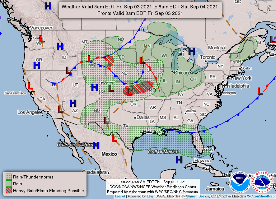
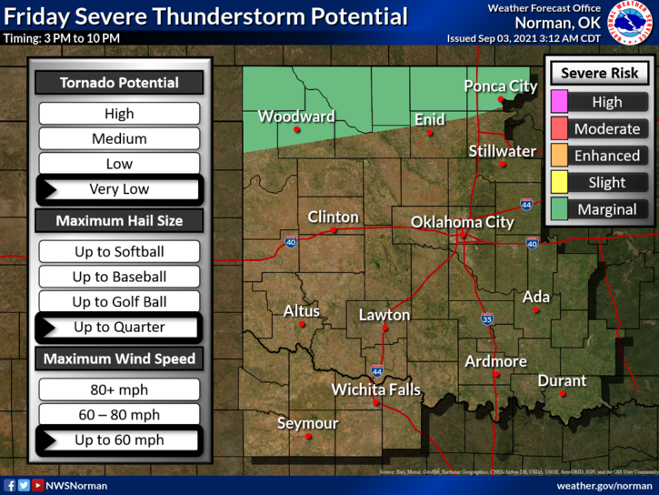
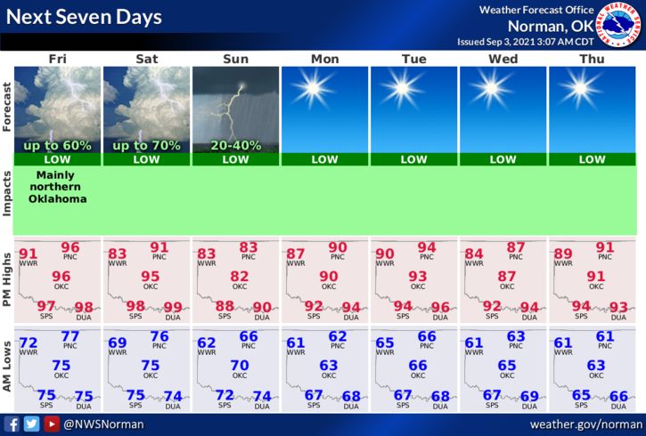
1- Several “IF’s” later today, tonight, and tomorrow. We are in a GENERAL thunderstorm area but very close to the MARGINAL line too. That said, thunderstorms could form in the area during the afternoon giving us that risk for a severe storm or two. Our chances are a little better as a cold front continues to creep our way. IF storms do occur, hail and wind will be the primary threats. Flooding could also become an issue in training storms so use caution while driving in storms, especially in low lying areas.
2- There is a chance for thunderstorms across the state all weekend though those chances are less than 50% in most areas. Just stay weather aware if you decide to travel and/or go to the lake and you should be ok. Just remember that if you can hear thunder, you can be struck by lightning. Have a good time but use your situational awareness skills while in those remote areas.
3- The heat will also be a problem today since temps will be in the upper 90s along with the heat index over 100. Continue to stay hydrated and use extreme caution while either working or playing outdoors.
4- Overall, we all should be ok so have fun, be careful, and travel safely if leaving the area. Here is your forecast from the NWS/NORMAN;
Today-Scattered showers and thunderstorms, mainly after 4pm. Mostly sunny and hot, with a high near 97. Heat index values as high as 105. South wind 9 to 13 mph. Chance of precipitation is 50%.
Tonight-Scattered showers and thunderstorms. Mostly cloudy, with a low around 73. South southeast wind around 10 mph becoming east in the evening. Chance of precipitation is 40%.
HAVE A GOOD DAY!
MIKE