0330L-SUNDAY OUTLOOK FROM GARFIELD COUNTY EMERGENCY MANAGEMENT-9/19/21
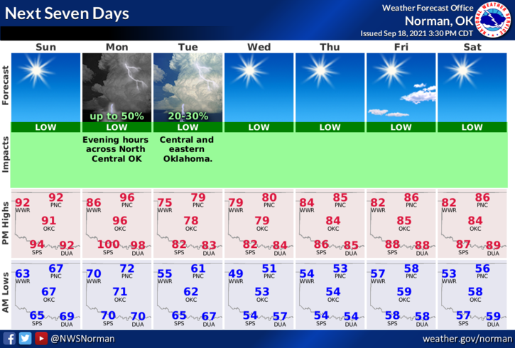
1-A few more days in the 90s and then cooler temps move in. Even if it’s only for a few days, it will be a nice break but we will warm back up into the 80s later in the week.
2- Thunderstorms are possible as the front pushes into the area but models are showing those to occur a little east of us. We’ll see what happens. Overall, enjoy the hot temps today and part of Monday. Here is your forecast from the NWS/NORMAN;
Sunday-Sunny. Highs in the mid-90s. Southeast winds around 10 mph.
Sunday Night-Clear. Lows in the upper 60s. South winds 10 to 15 mph.
FINALLY, I have been saying changes are coming to our GARFIELD COUNTY EM app. Changes are occurring but a bit slower than realized. I will keep you updated when the latest changes will occur along and the next update which will have radar with it.
STAY SAFE!
MIKE