FROM GARFIELD COUNTY EMERGENCY MANAGEMENT-SUNDAY 8/13/17
Download our “GARFIELD COUNTY EM“APP if you would like to keep up with severe weather events, advisories, and any major occurrence in the Garfield County area.
WOW!! No rain overnight. We have had quite a bit of rain over the past week and rain chances will hang around this up and coming week too. For the most part the pattern is going to change a little and we will actually warm up some. That said, just stay weather aware as chances for storms will vary depending on surface heating during the day and systems moving into the area from the high plains.
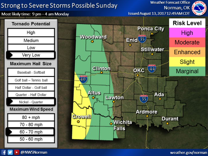
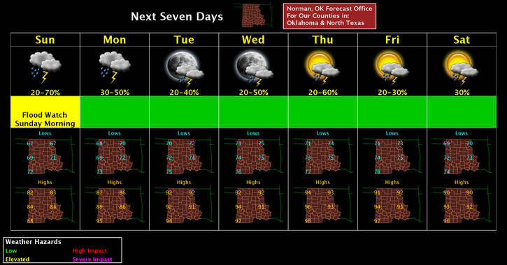
See graphs for the severe threat later today and tonight along with the 7 day forecast. REMEMBER, don’t get fixated on where lines are on any graph or map as they will fluctuate as the forecast modifies during the forecast period.
Here is your forecast from the NWS/NORMAN;
Sunday-30 percent chance of showers and thunderstorms, mainly between 7am and 1pm. Cloudy, then gradually becoming mostly sunny, with a high near 82. East northeast wind around 7 mph.
Sunday Night-30 percent chance of showers and thunderstorms after 1am. Mostly cloudy, with a low around 68. Southeast wind 5 to 8 mph.
HAVE A SUPER DAY!!
MIKE