0400L-SUNDAY UPDATE FROM ENID/GARFIELD COUNTY EMERGENCY MANAGEMENT-8/19/18
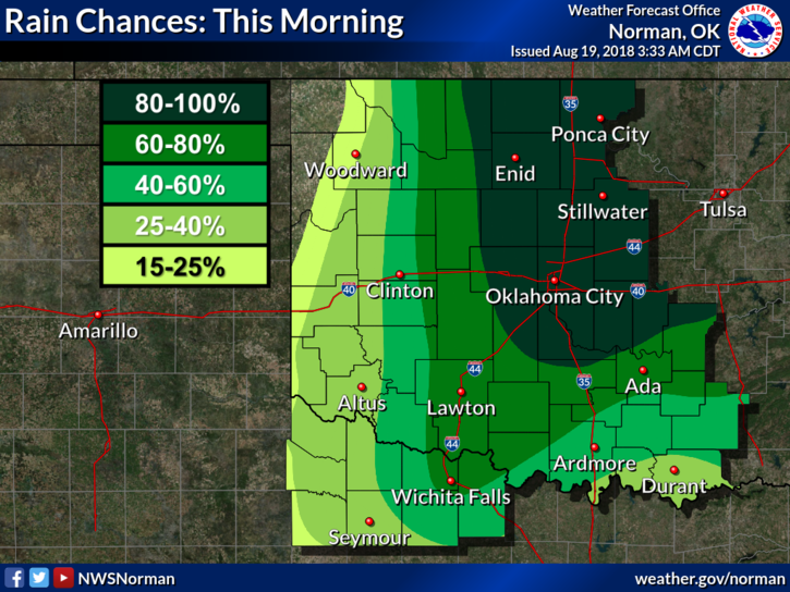
1- AT 0400 LOCAL TIME, SHOWERS AND THUNDERSTORMS ARE MOVING INTO THE AREA. NONE ARE SEVERE BUT WILL PRODUCE LIGHTNING, THUNDER, HEAVY RAINFALL, AND GUSTY WINDS.
2- There may be some flooding with these storms so just keep this in mind.
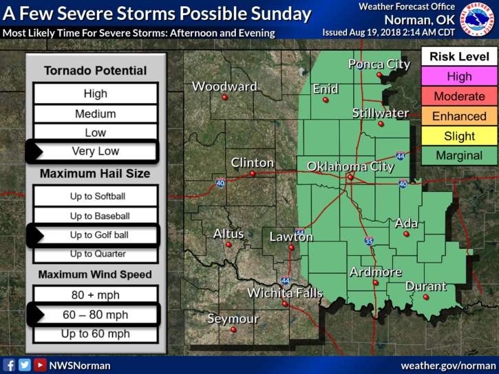
3- Overall, we’ll be ok and the main severe threat today after this initial wave this morning will be this afternoon as a front pushes into and through the area.
4- I’ll advise as needed.
5- Here is your forecast from the NWS/NORMAN;
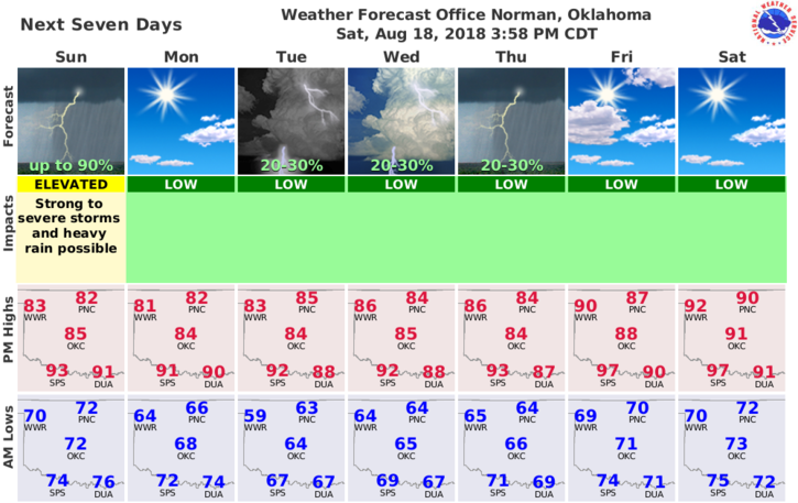
Today-Thunderstorms in the morning, then partly cloudy with a chance of thunderstorms in the afternoon. Highs in the lower 80s. South winds around 10 mph shifting to the west in the afternoon.
Tonight-Mostly clear. Lows in the upper 60s. Northwest winds around 10 mph.
HAVE A GOOD DAY!!
MIKE