0400L-SATURDAY UPDATE FROM ENID/GARFIELD COUNTY EMERGENCY MANAGEMENT-8/18/18
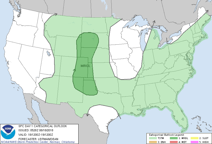
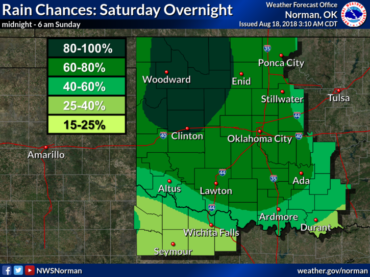
1- RAIN CHANCES WILL BE CREEPING UP THROUGHOUT THE DAY FROM WEST TO EAST. THOSE CHANCES INCREASE FOR OUR AREA LATER TODAY INTO THE EVENING AND OVERNIGHT HOURS. WE ARE IN A “GENERAL RISK” AREA FOR HEAVY WEATHER LATER TODAY AND TONIGHT.
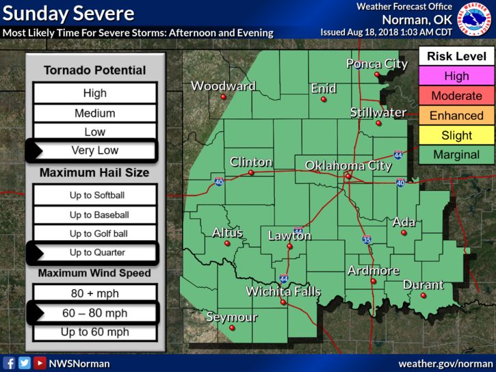
2-We’ll be in a MARGINAL RISK AREA on Sunday for the possibility of severe weather mainly in the afternoon and evening. Overall, we’ll be ok.
3-I will send out a “GARFIELD COUNTY EM” APP UPDATE later today as new information becomes available concerning tonight’s heavier weather. Biggest threat appears to be heavy rainfall that could lead to flooding.
4- Here is your forecast from the NWS/NORMAN;
Today-Partly cloudy. Highs in the upper 80s. Light and variable winds becoming east around 10 mph in the afternoon.
Tonight-Thunderstorms after midnight. Some thunderstorms may produce heavy rainfall after midnight. Lows around 70. Southeast winds around 10 mph in the evening becoming light and variable. Chance of thunderstorms 80 percent.
HAVE A GOOD DAY!!
MIKE