SUNDAY AFTERNOON UPDATE FROM GARFIELD COUNTY EMERGENCY MANAGEMENT-10/25/2020
PLEASE READ THIS COMPLETELY.
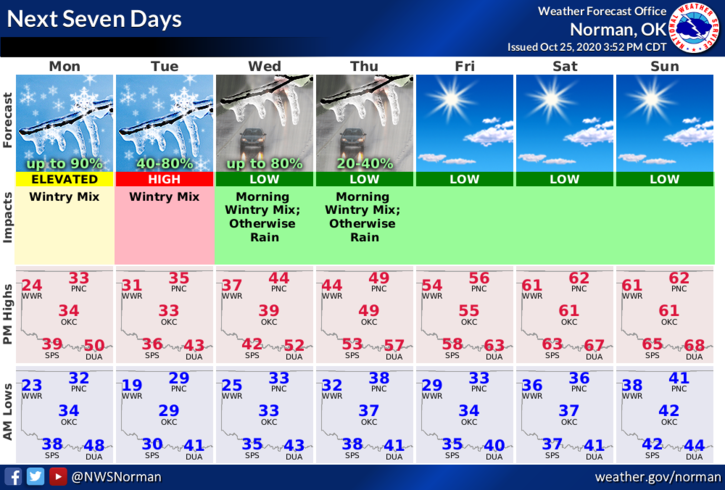
“WINTER WEATHER ADVISORY” IN EFFECT FOR OUR AREA STARTING MONDAY MORNING AT 4 AM UNTIL 7PM MONDAY EVENING AND THEN WE TRANSITION TO A WINTER STORM WATCH FROM 7PM MONDAY EVENING UNTIL WEDNESDAY EVENING AT 7PM.
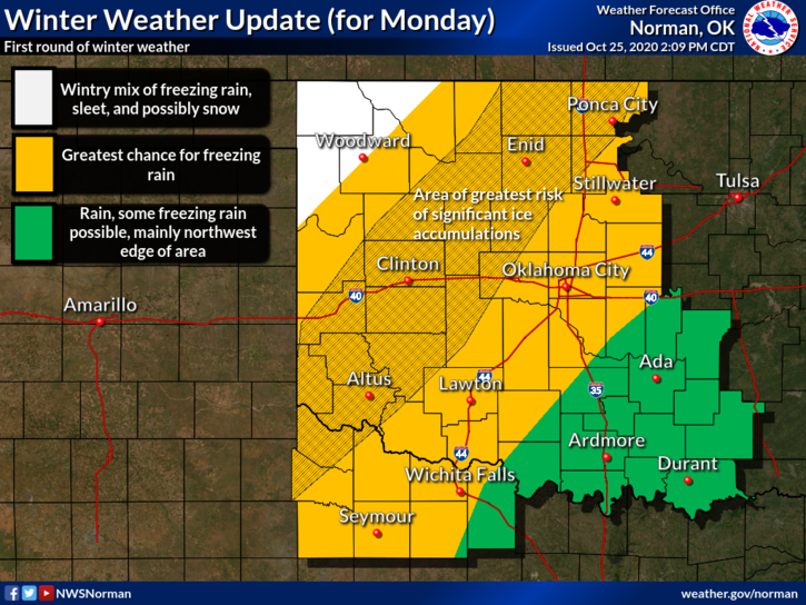
Between now and then we’ll see some freezing precipitation as temps drop and the precip begins. Thinking is that for our area we will see sleet and some freezing rain initially but we’ll see a lull in activity by late afternoon, as it looks right now. There may still be some precip but it should be light.
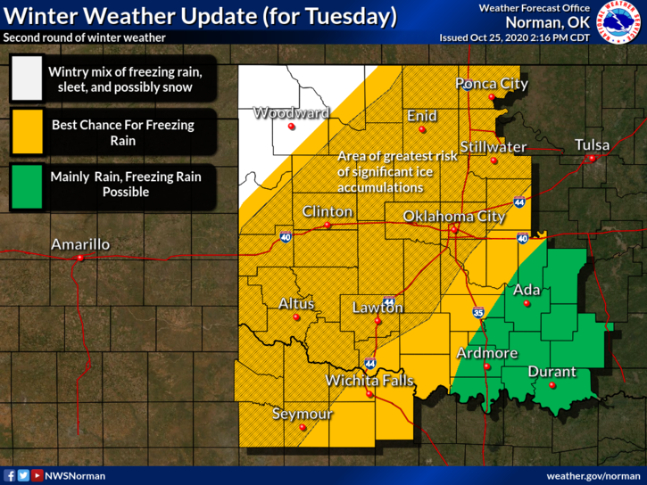
Monday night into Tuesday- This timeframe should be interesting especially if temps are around 28 degrees per guidance. I am copying a portion of the latest discussion instead of re-interpreting it for you.
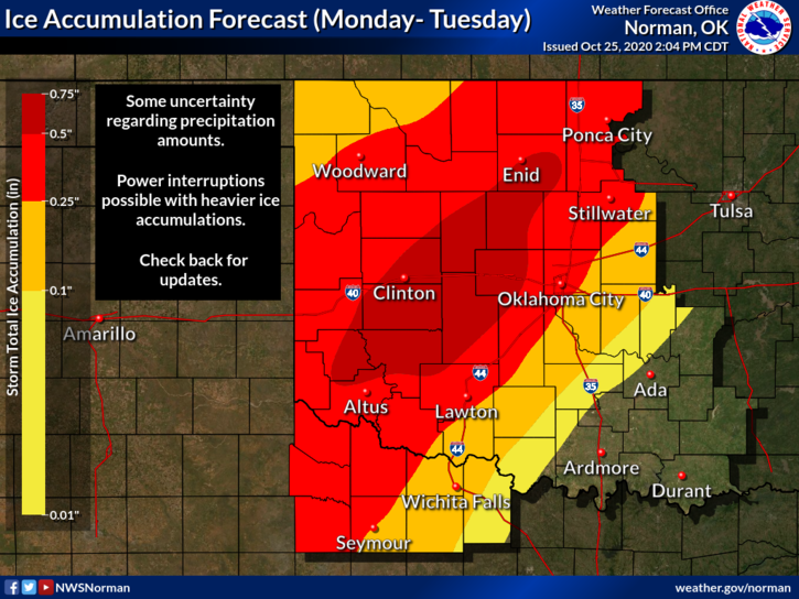
“THE MOST SUBSTANTIAL ICE ACCUMULATIONS TEND TO OCCUR WHERE TEMPERATURES ARE AROUND 28 DEG F AND COLDER COINCIDENT WITH THE HIGHEST QPF. THIS APPEARS MOST LIKELY JUST NORTH AND WEST OF I-44 (I.E., JUST NORTH AND WEST OF OKC, LAWTON, AND WICHITA FALLS) –BUT IT WILL BE CLOSE. CURRENTLY, OUR HIGHEST ICE ACCUMULATIONS ARE FROM NEAR ENID, TO KINGFISHER, TO EL RENO, AND TO HOBART. AREAS ACROSS NORTHWEST OKLAHOMA SHOULD HAVE MORE SLEET MIX IN WITH THE FREEZING RAIN, WHICH SHOULD RESULT IN LOWER ICE ACCUMULATIONS.”
Temperature means everything here and remember that surface temps are in the 50’s. There may be areas where roads get bad but ELEVATED areas will see worse like trees, powerlines, overpasses, etc. PER THE GRAPHICS ATTACHED— The circles and lines are FLUID. They will change as the forecast changes and verifies.
There is no need to panic over this as we have faced this in the past. TAKE YOUR TIME AND READ THIS CAREFULLY. Read the graphics carefully. If you don’t understand it, read them again.
If you want to read the whole discussion, here is the link- https://forecast.weather.gov/product.php?site=NWS&issuedby=OUN&product=AFD
OVERALL, WE’LL BE OK. If it’s slick out there, stay at home drive with extreme caution.
HAVE A GOOD EVENING.
MIKE