0405L-SUNDAY OUTLOOK FROM GARFIELD COUNTY EMERGENCY MANAGEMENT- 10/25/2020
FREEZE WATCH IN EFFECT FROM 10PM TONIGHT THROUGH MONDAY MORNING AT 10 AM.
GARFIELD COUNTY EM is our notification app. Preparedness here starts with our app. If you don’t have it and live here, you will need it. Download it, learn it, and be better prepared.
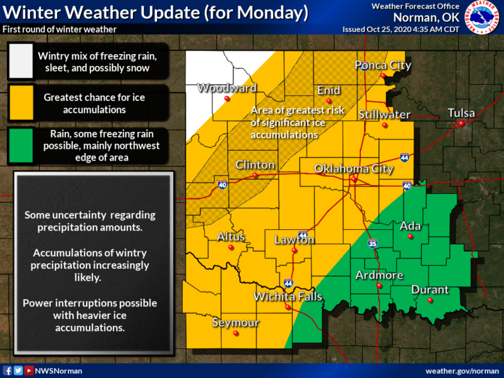
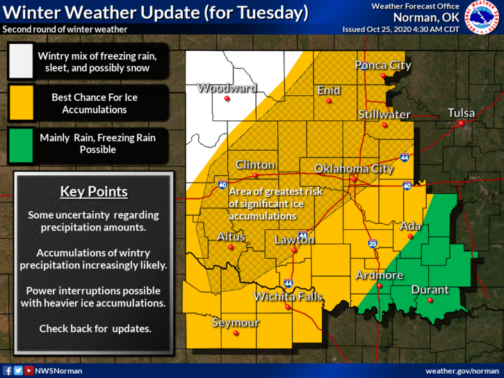
1- We are in a GENERAL RISK AREA for thunderstorms later today into the overnight hours. With a cold front pushing in, a storm system out west pushing troughs our way, and some moisture moving up and over the top of this mess, we might see some freezing precipitation late tonight into tomorrow. What type for sure will depend on what happens aloft temperature-wise at different levels. It’s a mess. We’ll see what happens as all of this comes together. If it rains, it will be slick due to freezing rain or drizzle so either way, slow down and take your time.
2- Per guidance, right now, we MIGHT SEE somewhere around ½ inch of precip this week. It may be freezing rain but at least its water related. There may be power outages as the winds will increase as we receive the freezing precipitation. Just be prepared for this possibility. OVERALL, we should be ok but wind and ice don’t get along too well.
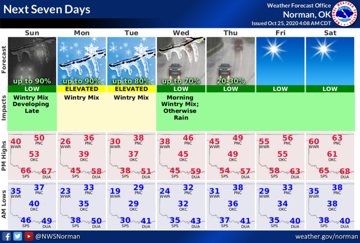
3- Here is your forecast from the NWS/NORMAN;
Today-Cloudy. A slight chance of drizzle in the morning, then a chance of drizzle in the afternoon. Highs in the lower 50s. Northeast winds 10 to 15 mph.
Tonight-Cloudy. A chance of drizzle in the evening, then rain or light freezing rain likely after midnight. Lows in the upper 20s. North winds 15 to 20 mph. Chance of precipitation 70 percent.
HAVE A GOOD DAY!!
MIKE