0330L-SUNDAY OUTLOOK FROM GARFIELD COUNTY EMERGENCY MANAGEMENT-02/26/23
* Download our GARFIELD COUNTY EM app today and stay up to date with NWS and OUR WARNINGS.
*WIND ADVISORY IN EFFECT FROM 4PM TODAY UNTIL 6AM MONDAY MORNING.
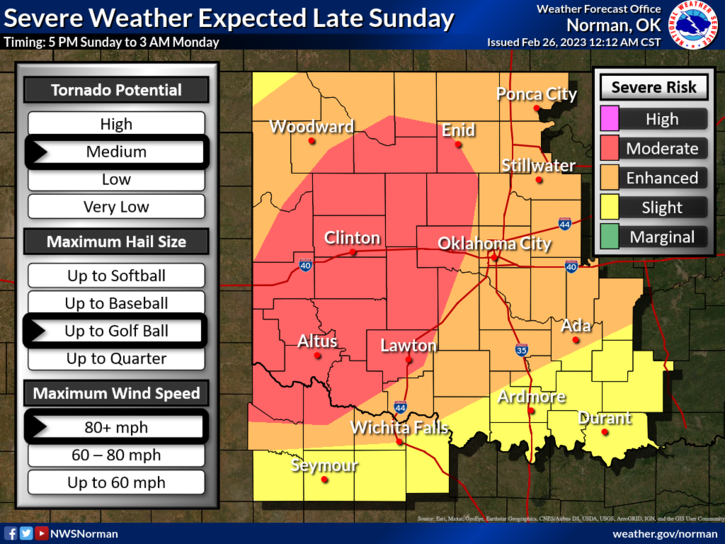
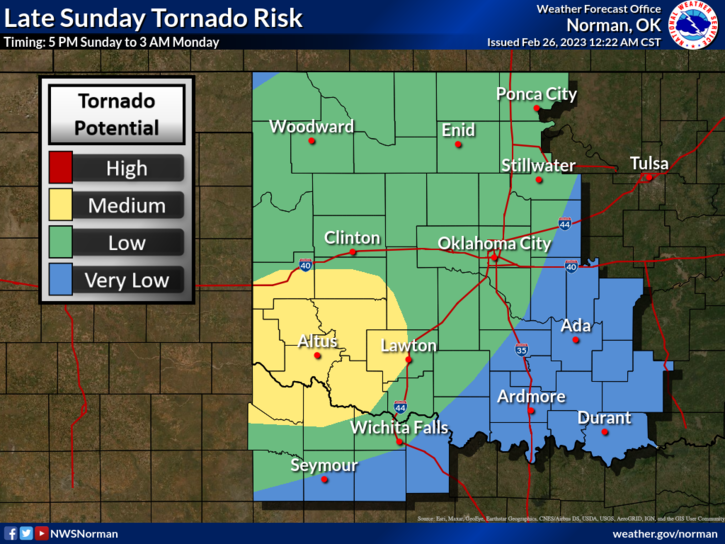
*MODERATE RISK FOR SEVERE WEATHER THIS EVENING. With all risks possible, winds and hail are our most likely concerns. The Tornado threat is low for our area but not out of the question.
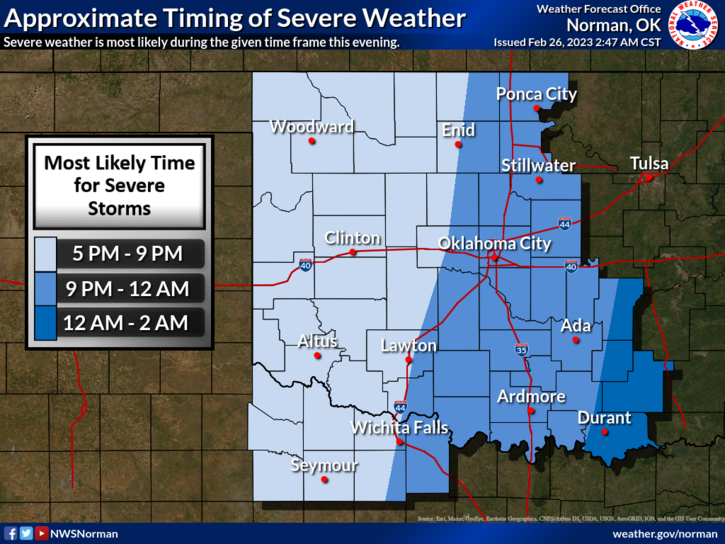
*Torrential rainfall, high winds, possibly quarter size hail, and a low risk for tornadoes are expected in the state tonight. The severity of the storms WILL NOT Diminish as we move into the overnight time frame so in our area, the timeline puts us in the 5-9 timeframe but this could go on through midnight.
*Garfield County Emergency Services Spotters have been notified of possible activation later today. Rest assured; these folks know what they are doing.
* SECURE anything on your property that could take flight and we’ll deal with the aftermath when it’s over. This won’t be the only storm we deal with this year so make sure you have your preparedness plan up-to-date.
* Overall, we’ll be ok so here is your forecast from the NWS/NORMAN:
Today-Mostly cloudy. A chance of showers this afternoon. Not as cool with highs in the mid-60s. South winds 15 to 20 mph with gusts up to 30 mph. Chance of rain 30 percent.
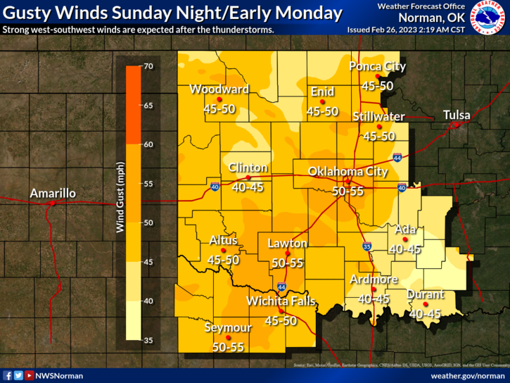
Tonight-Showers with thunderstorms likely in the evening, then mostly clear after midnight. Some thunderstorms may be severe with damaging winds. Very windy with lows in the mid-40s. South winds 25 to 35 mph, becoming southwest after midnight. Gusts up to 50 mph. Chance of rain near 100 percent.
* I have another briefing with NWS officials at 11 so we’ll update this afternoon.
HAVE A GOOD DAY!!