0340L-SATURDAY OUTLOOK FROM GARFIELD COUNTY EMERGENCY MANAGEMENT-02/25/23
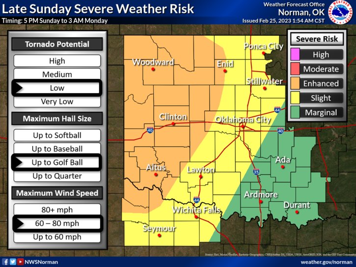
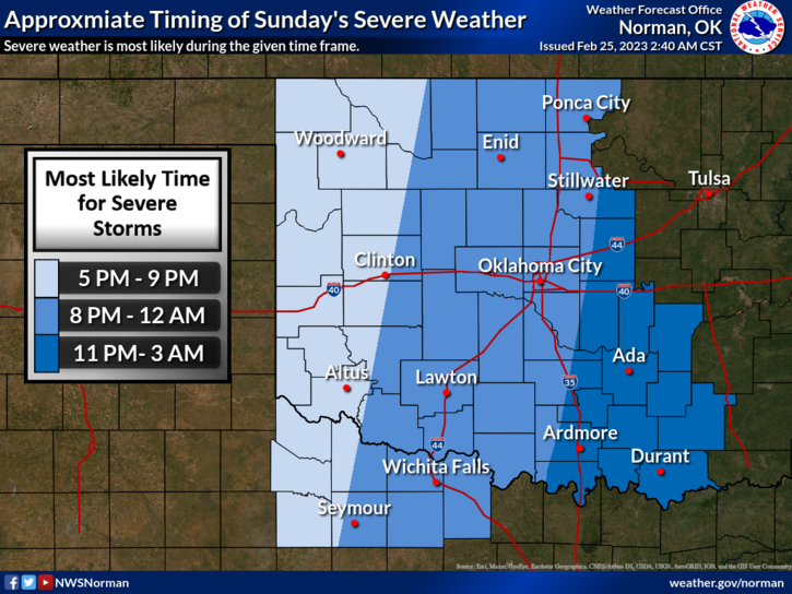
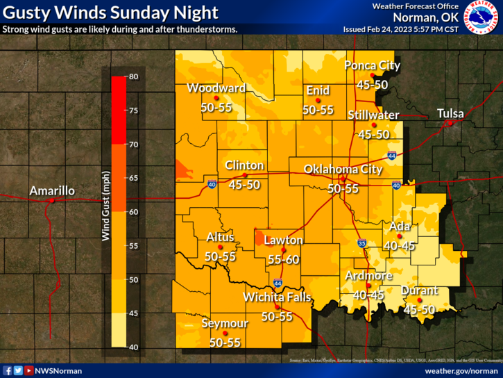
* Warmer today with a chance for showers overnight. At least we’ll be above freezing. Sunday evening will be the main event with a very strong storm system that will push through the area. As this occurs Sunday evening, ALL HAZARDS are possible. That said, everything depends on timing but I think our biggest threat, as it looks right now, will be the winds since this will come across as a QLCS system type squall line. These are the type where tornadic weather could occur along the leading edge of a squall line. We’ll see what happens.
*With the storm system moving across with a dryline ahead of it, there will be a cold front associated with this mess too. We have another briefing today at 11 so I will send an update out this afternoon.
* This is our first forecast severe event in a while so NO NEED TO PANIC, WE’LL BE OK. If you want to keep up with discussions, here is a link to the NWS/NORMAN- https://www.weather.gov/oun/ Also here is a link to the Storm Prediction Center- https://www.spc.noaa.gov/
* Overall, we’ll be ok so here is your forecast from the NWS/NORMAN:
Today- Partly sunny this morning, then becoming mostly cloudy. Not as cool with highs in the upper 40s. South winds 5 to 10 mph.
Tonight-Mostly cloudy with a slight chance of showers and thunderstorms. Not as cool. Near steady temperature in the lower 40s. South winds around 10 mph. Chance of rain 20 percent.
HAVE A GOOD DAY!!