0415L-SUNDAY UPDATE FROM GARFIELD CO. EMERGENCY MANAGEMENT-1/21/18
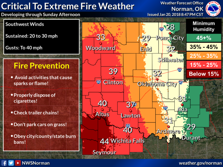
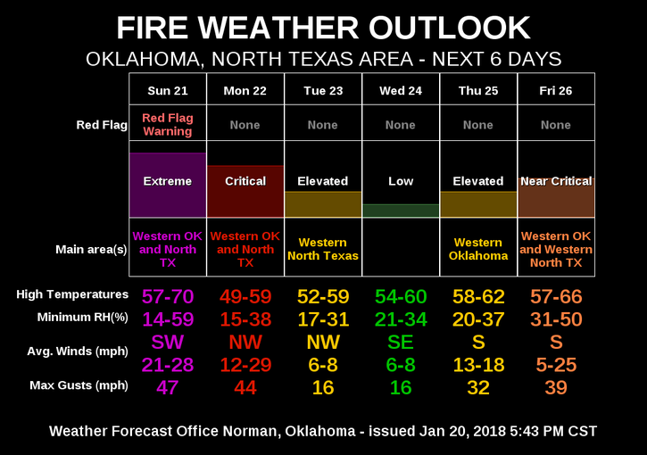
1- FIRE WEATHER WATCH IN EFFECT “TODAY” FROM 11 AM UNTIL 9 PM THIS EVENING.
2- Report ANY smoke or fire you see to 911 immediately.
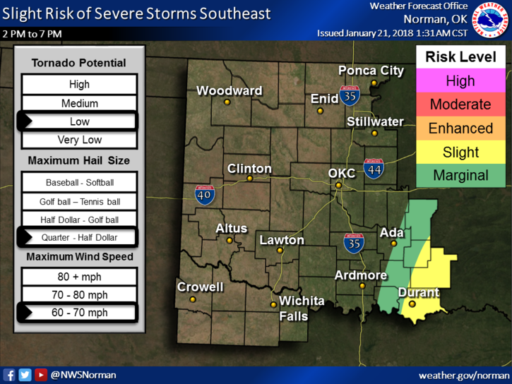
3- If you plan on traveling, winter watches in effect to our north and northwest in Kansas, slight risk of severe weather in southeast Oklahoma. Both events carry into several states so check the NWS WEBSITE nearest to your destination. Links to NWS sites NEAREST TO US IN 7 STATES are here- https://gcem.org/links/
4-QUICK NOTE on a structure fire that occurred west of Enid yesterday. Drummond, Enid, Hillsdale-Carrier, Lahoma fire departments, & E/GCEM all responded to a structure fire yesterday. The main cause for this fire was a power line that was rubbing against the structure and eventually rubbing through the wire coating thus causing sparks and the rest is history. Look outside to see if the line that runs to your residence OR business is rubbing against the roof or anything, call OGE and get that fixed. It could mean the difference between being comfortable or staying in a motel for a while.
5-Again- FIRE DANGER IS HIGH TODAY SO BE EXTREMELY CAREFUL.
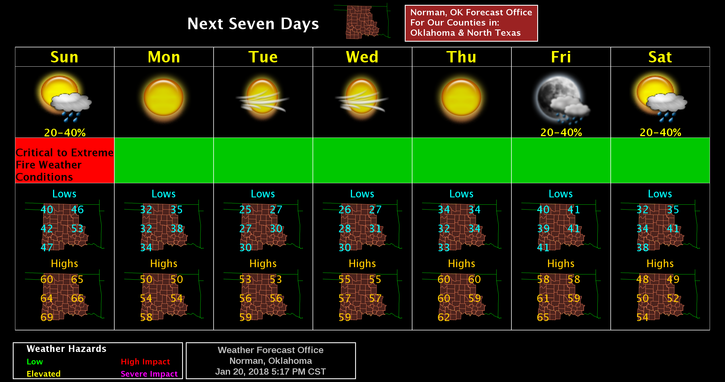
6- Here is your forecast from the NWS/NORMAN; Sunday-Cloudy, then clearing this afternoon, with highs near 63. South wind 15 to 25 mph gusting to 30.
Sunday Night-Partly cloudy, with lows around 34. South southwest wind 15 to 25 mph becoming west northwest after midnight and gusting to 35 mph.
HAVE A SUPER DAY!!
MIKE