0420L-SUNDAY OUTLOOK FROM GARFIELD COUNTY EMERGENCY MANAGEMENT-7/18/21
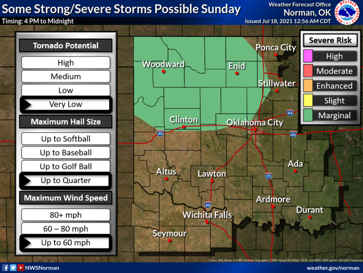
1-HOT & HUMID again today with a MARGINAL RISK for thunderstorms. If storms do occur, expect strong winds, large hail, & torrential rainfall. Storms won’t move very quickly so there is a chance for localized flooding. Overall, the trend we are in will continue into the foreseeable future. Here is your forecast from the NWS/NORMAN;
Today-Partly cloudy with a chance of thunderstorms. Highs in the lower 90s. Light and variable winds becoming northeast around 10 mph in the afternoon. Chance of thunderstorms 40 percent.
Tonight-Partly cloudy with a slight chance of thunderstorms. Lows in the upper 60s. East winds around 10 mph in the evening becoming light and variable. Chance of thunderstorms 20 percent.
2- I have added additional graphs from WICHITA AND DODGE CITY NWS offices.
Have a good day!
MIKE