0415L-SATURDAY OUTLOOK FROM GARFIELD COUNTY EMERGENCY MANAGEMENT-7/17/21
I have added graphs from both Wichita and Dodge City along with Norman’s NWS offices.
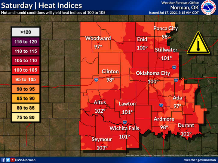
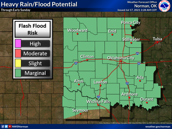
1- HOT & HUMID with a chance for thunderstorms. IF STORMS OCCUR, expect strong winds, possibly large hail, torrential rainfall, and intense lightning. Storms won’t be moving fast so there is a chance for localized flooding too. Use caution while driving.
2-The heat will become an issue today as the heat index rises to at least 100 degrees. If working outdoors, stay hydrated to lessen the possibility of heat exhaustion and stroke. Two of the true signs that trouble is brewing is you “quit sweating” and then you get “extremely weak”. This is why we ask that you stay hydrated.
3- Here is your forecast from the NWS/NORMAN;
Saturday-A slight chance of showers and thunderstorms before 7am, then a chance of showers and thunderstorms after 1pm. Mostly sunny, with a high near 94. Heat index values as high as 100. South wind 6 to 9 mph. Chance of precipitation is 30%.
Saturday Night-30 percent chance of showers and thunderstorms, mainly before 10pm. Mostly cloudy, with a low around 70. East southeast wind 5 to 10 mph.
4- GARFIELD COUNTY EM is our notification app. Either you’re prepared or you’re not. Which one are you?
HAVE A GOOD DAY!!
MIKE