0435L-SUNDAY OUTLOOK AND INFO FROM GARFIELD COUNTY EMERGENCY MANAGEMENT-7/21/19
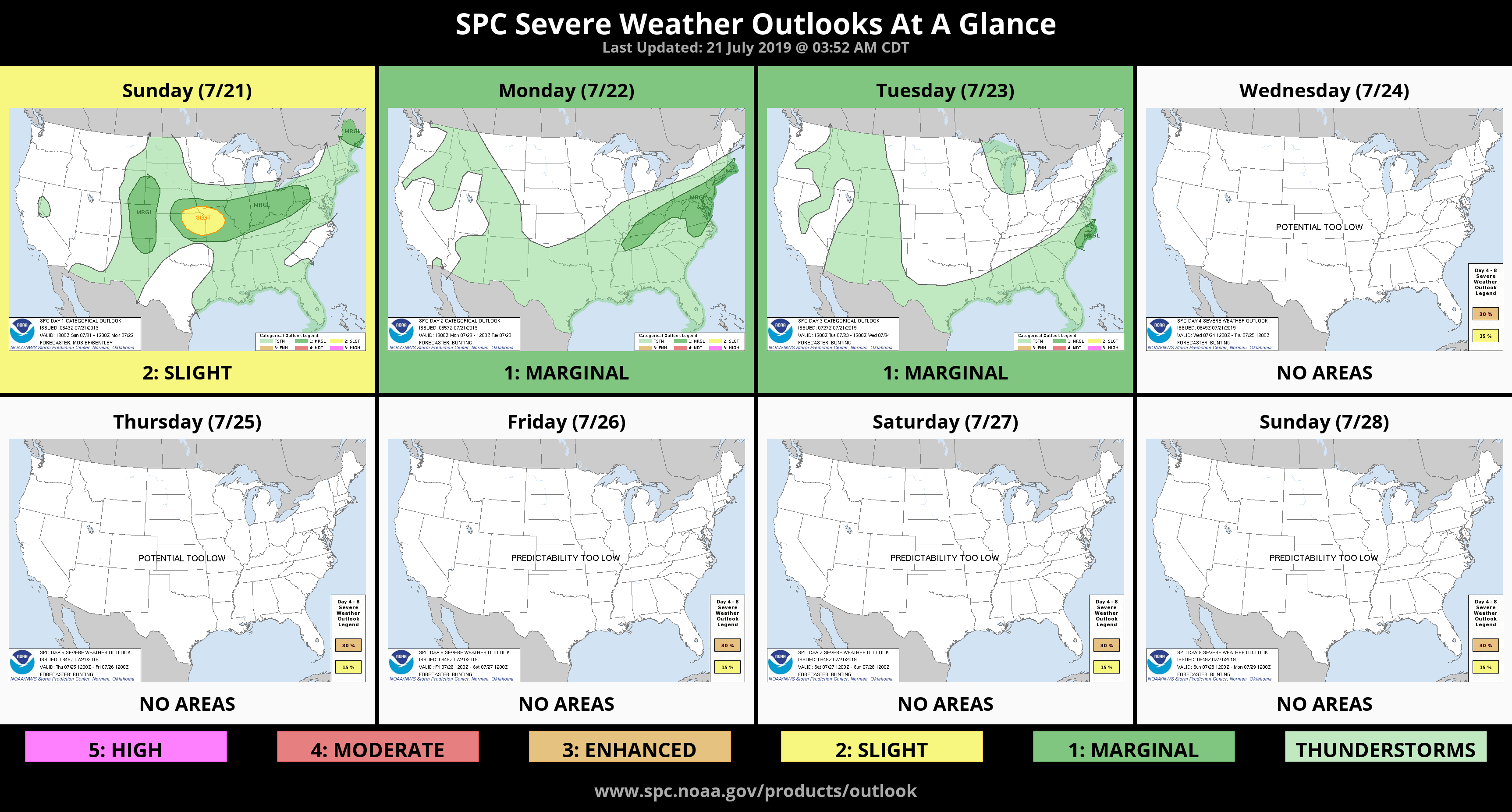
GENERAL THUNDERSTORM RISK LATER TODAY-HEAT ADVISORY CANCELLED FOR OUR COUNTY FOR NOW.
1-Here is a really big MAYBE, RAIN is in the forecast for later today. It’s a very low chance but since I watered the yard yesterday, maybe it will. If storms do occur and go severe, the threat would be due to high winds.
2- Cooler weather will be very noticeable after this Canadian front pushes through. We definitely won’t complain having lower temps and a little relief from the heat.
3-Reminder that FEMA will be back “Monday” morning at 8 am at the office to help those affected by the storms last May.
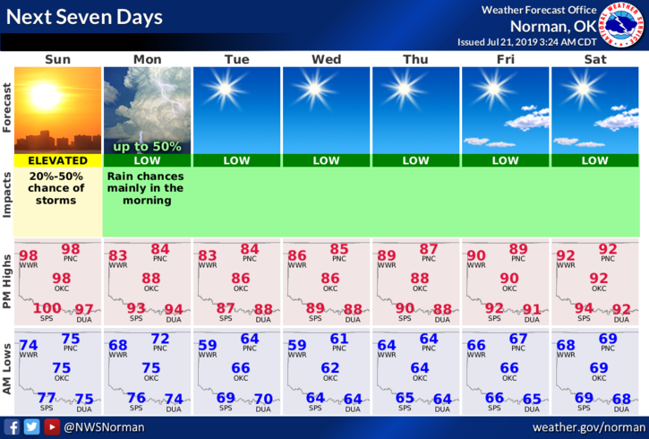
4- Here is your forecast from the NWS/NORMAN;
Today-20 percent chance of showers and thunderstorms after 4pm. Mostly sunny and hot, with a high near 101. Heat index values as high as 104. South wind 7 to 13 mph.
Tonight-40 percent chance of showers and thunderstorms, mainly after 10pm. Mostly cloudy, with a low around 72. South wind 8 to 14 mph becoming north after midnight. Winds could gust as high as 20 mph.
HAVE A GREAT DAY!!
MIKE