0310L-SUNDAY OUTLOOK FROM GARFIELD COUNTY EMERGENCY MANAGEMENT-7/30/23
*HEAT ADVISORY IN EFFECT FOR TODAY(SUNDAY) FROM NOON UNTIL 8PM THIS EVENING. Heat index values to 105 are expected. Here is a link to HEAT SAFETY from the NWS- https://www.weather.gov/safety/heat
*As stated yesterday, the latest Drought Monitor has us in a MODERATE DROUGHT for most of the county and in a SEVERE DROUGHT in the northeast part of the county. If we continue to receive some rainfall, it just might get a bit better before we move into the fall and winter months. We’ll have to wait and see what happens. It’s still going to remain hot outside.
*The FIRE DANGER continues upwards. If you decide to do any controlled burning, call it in to dispatch. 580-234-FIRE (3473). If it gets out of control, call 911.
Be sure to download our GARFIELD COUNTY EM app and remember that the information I post on social media each day is located on our app under GCEM Blog and on the front page of our website at gcem.org.
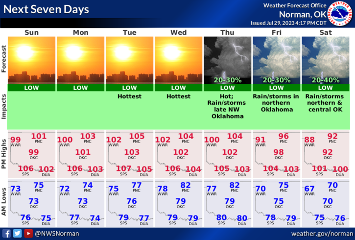
*Overall. We’ll be ok so here is your Sunday forecast from the NWS/NORMAN;
Sunday-Sunny and hot, with a high near 101. South wind 6 to 10 mph.
Sunday Night-Mostly clear, with a low around 74. South wind 8 to 10 mph.
HAVE A GOOD DAY & STAY COOL.