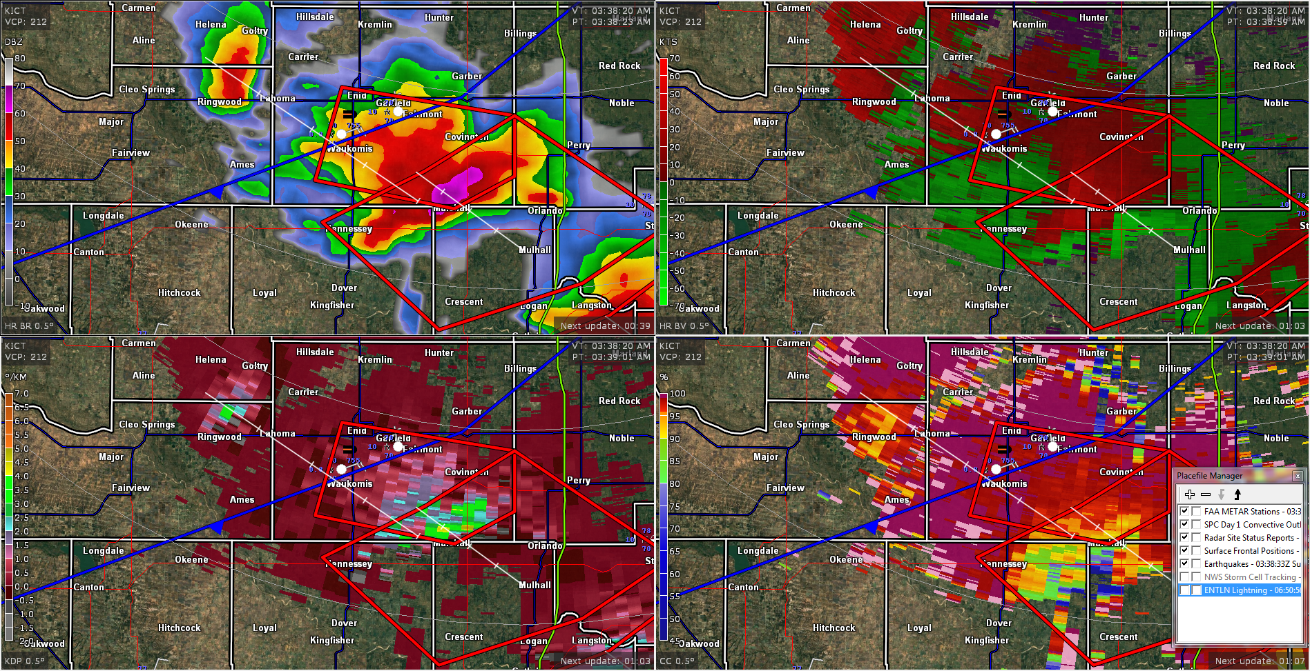
FROM GARFIELD COUNTY EMERGENCY MANAGEMENT-SUNDAY JUNE 18, 2017
It’s 0343 at this writing and we are under a severe thunderstorm warning. The biggest threat is the possibility of PING PONG BALL size hail. The main cores right now, are over mostly rural areas so if you have had large hail, let us know. Send that info to us through the app or email it to me at mike@gcem.org
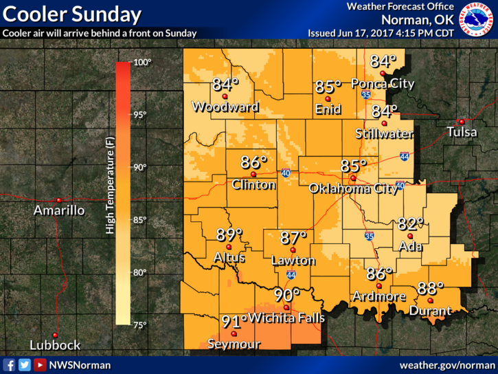
Overall, expect some bumpy weather over the next few hours and enjoy the cooler weather during the day.
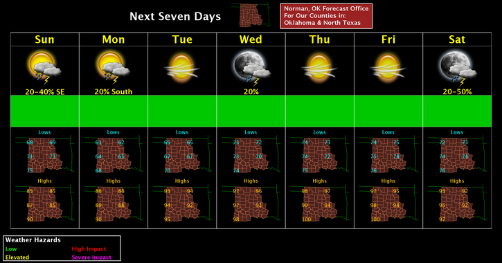
Here is your forecast from the NWS/NORMAN;
Sunday-30 percent chance of showers and thunderstorms before 7am. Cloudy, then gradually becoming mostly sunny, with a high near 79. North northeast wind 13 to 16 mph, with gusts as high as 23 mph.
Sunday Night-Mostly clear, with a low around 61. Northeast wind 5 to 9 mph becoming light east in the evening.
Finally, I am attaching the latest radar pic from my computer and some graphs from the NWS.
HAVE A GREAT DAY!!
Mike