FROM GARFIELD COUNTY EMERGENCY MANAGEMENT
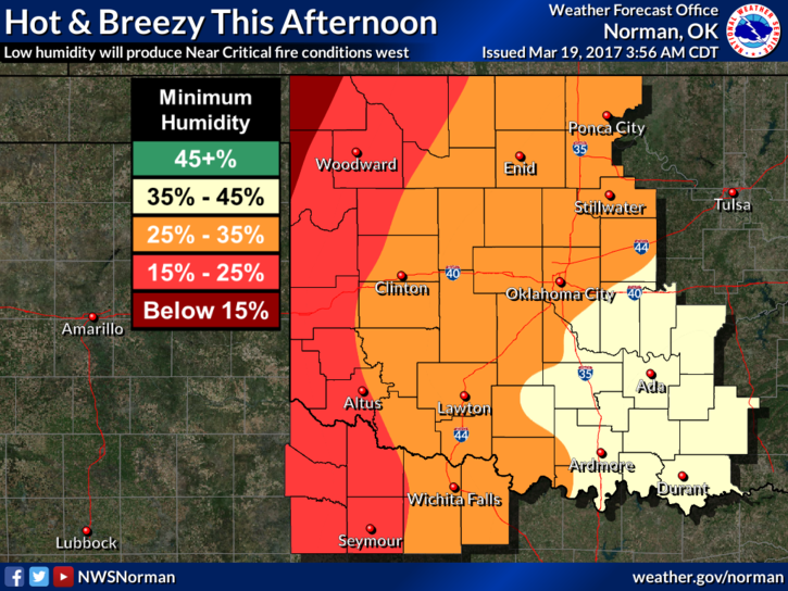
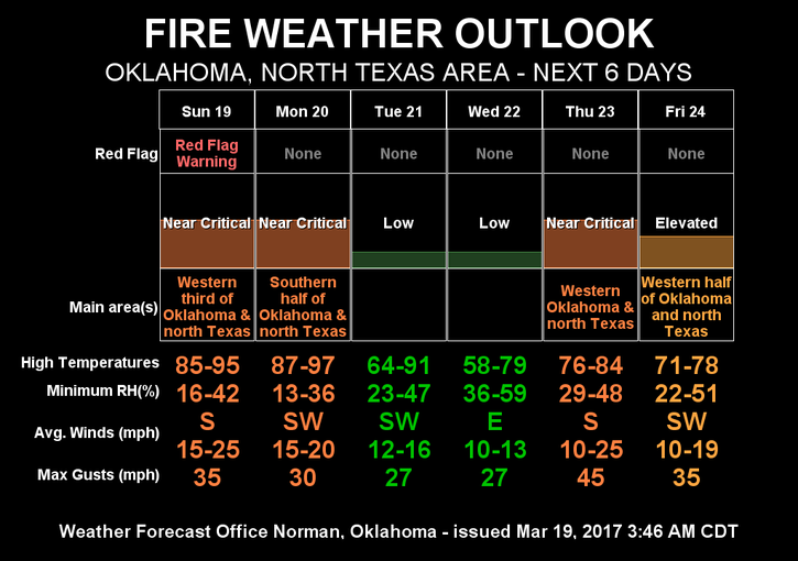
RED FLAG WARNING in effect for our western counties today. We are not included but don’t let those lines on the map deceive you. The fire danger is real so continue to be alert for smoke and fires out there.
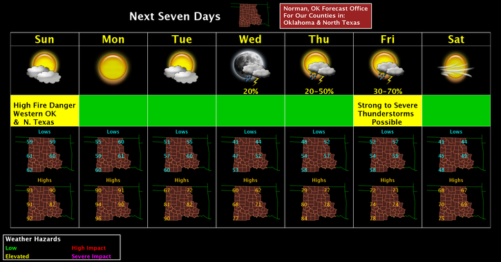
There are some low percentages for rain this week along with a few fronts that won’t have much effect on temps. Best rain chances will be later this week as it appears right now and we may even cool off for next weekend a little. That is a long ways out right now and all this could change. Stay up with the latest from us and the NWS.
Here is your forecast for Sunday;
Sunny with highs near 90. South southwest winds 10 to 15 mph increasing to 20 to 25 mph gusting as high as 37 mph.
Tonight’s low around 60. South winds 15 to 25 mph gusting as high as 30 mph.
HAVE A SUPER DAY!!
MIKE