FROM GARFIELD COUNTY EMERGENCY MANAGEMENT
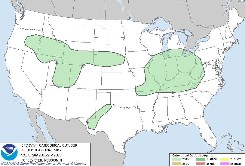
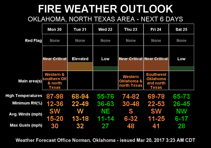
This is going to be an interesting week. The Fire Danger will continue to persist. There is even a chance for rain later in the week but it appears to possibly happen east of us. It is several days out and we can hope in occurs farther west. I am going to start including the Storm Prediction Center Graph for the SWODY 1 outlook, (severe weather outlook day 1). Hopefully I don’t forget to do this each day.
REMINDER- National Weather Service Storm Spotter Training here tomorrow night at 6:30pm at 216 West Oxford. You can park on either side of the building and we will be meeting on the west end in the sheriff’s training room. THE PUBLIC IS WELCOME.
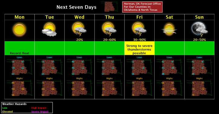
Here is your forecast for Monday;
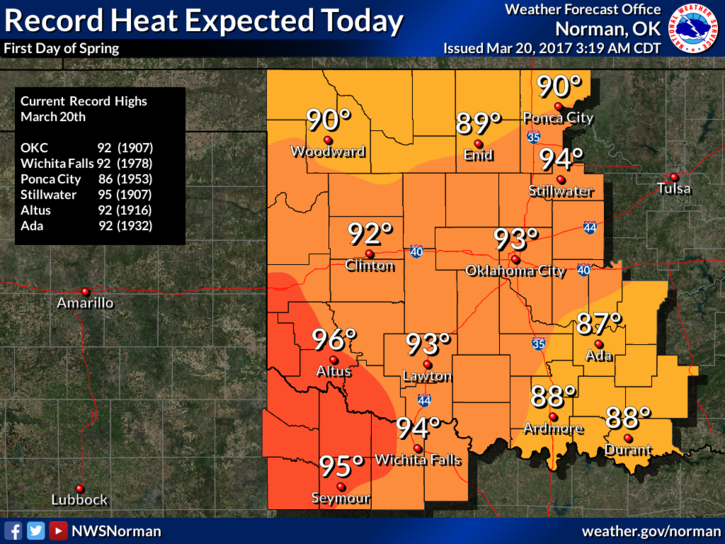
Sunny, with highs temperatures around 90. SSW winds 5-15 mph
Tonight’s low around 54 with NE winds 5-10 mph
HAVE A SUPER DAY AND STAY SAFE.
MIKE