0435L-SUNDAY UPDATE FROM ENID/GARFIELD COUNTY EMERGENCY MANAGEMENT-5/13/18
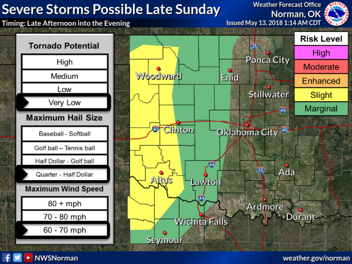
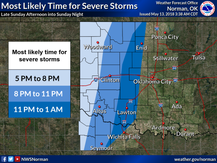
1-MARGINAL RISK FOR POSSIBLY SEVERE WEATHER TONIGHT. If storms form out west later today, they may make a run for our area. They may hold together, they may not. Either way, main risks if they do make it would be hail and winds. We’ll see what happens.
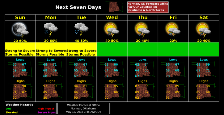
2- Monday, we’ll be in a Slight Risk meaning a better chance for severe weather. Hail and winds will be the main threats along with a very low chance for tornadoes.
3-In a radar refresher class this year, we focused on Quasi-linear Convective Systems, ie, Squall Lines. There is a potential for these tomorrow. Should be interesting.
4- Here is your forecast from the NWS/NORMAN;
Today-Partly sunny with a high near 91. South wind 10 to 15 mph, with gusts as high as 25mph.
Tonight-20 percent chance of showers and thunderstorms. Mostly cloudy with a low around 69. South wind 15 to 20 mph with gusts as high as 25 mph.
HAVE A SUPER DAY!!
MIKE