0410L-MONDAY OUTLOOK FROM ENID/GARFIELD COUNTY EMERGENCY MANAGEMENT-5/14/18
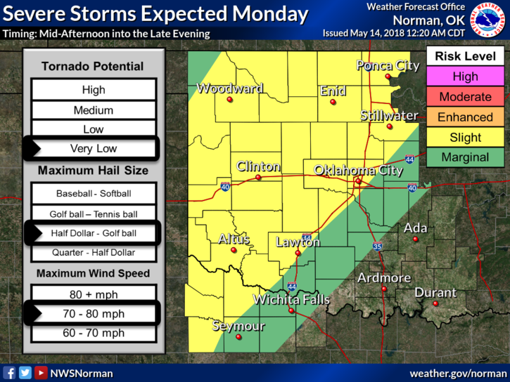
1- SLIGHT RISK FOR SEVERE WX LATER THIS AFTERNOON AND EVENING. MAIN THREATS- WIND AND HAIL
2-The wind threat could be from convective downdrafts which can produce very high winds. Just be prepared for this as we don’t see these for the most part until winds start affecting an area. These can occur without warning and produce quite a bit of damage.
3- As for rainfall, if you find yourself under one of the heavier storms, you may see some very heavy rainfall with “localized” flooding. It will come fast. Just remember, turn around, don’t drown.
4-Overall, we’ll be ok. Just understand that severe storms are forecast so get prepared and we should be ok. You don’t need to panic unless I do and that’s unlikely.
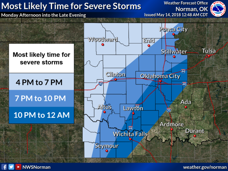
5- Here is your forecast from the NWS/NORMAN;
Today-Decreasing clouds. Isolated showers and thunderstorms this morning, then a slight chance of showers and thunderstorms this afternoon. Some thunderstorms may produce damaging winds, and large hail this afternoon. Highs in the lower 90s. South winds 15 to 20 mph. Chance of precipitation 20 percent.
Tonight-Mostly cloudy. Showers and thunderstorms likely, mainly in the evening. Some thunderstorms may be severe with damaging winds, and heavy rainfall in the evening. Locally heavy rainfall possible in the evening. Lows in the upper 60s. Southeast winds 10 to 20 mph. Chance of precipitation 70 percent.
FINALLY, WE WILL TEST THE ENID STORM SIRENS WITH A SHORT BURST AT NOON TODAY, WEATHER PERMITTING.
HAVE A SUPER DAY!!
MIKE