0355L-SUNDAY OUTLOOK FROM ENID/GARFIELD COUNTY EMERGENCY MANAGEMENT-11/11/18
1- WINTER WEATHER ADVISORY IN EFFECT FROM 6PM SUNDAY EVENING UNTIL 12 NOON ON MONDAY.
A Winter Weather Advisory for snow means periods of snow will cause travel difficulties. Expect snow covered roads and limited visibilities, and use caution while driving. Road Conditions can be found here: http://ok.maps.arcgis.com/apps/Viewer/index.html?appid=023e821ebf7b4acd999ccfd58d92c3da
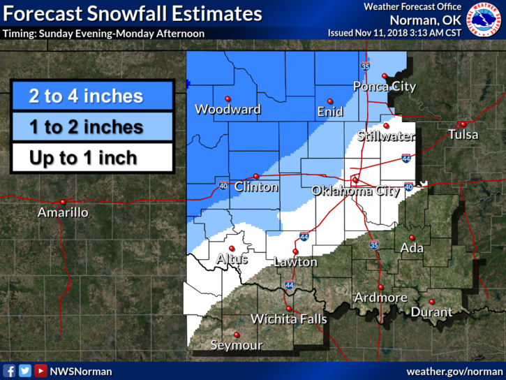
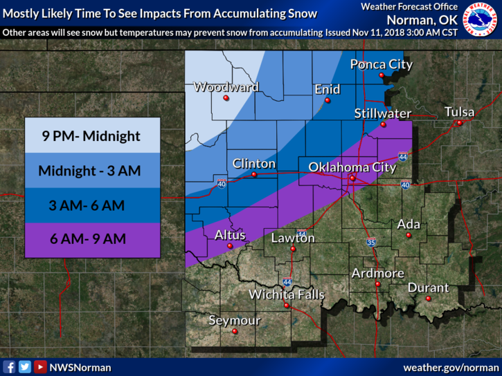
2- For all snow folks, we aren’t expecting snow to occur here in our area until this evening. It doesn’t mean it won’t start early but the heavier stuff will be mostly overnight. SEE GRAPHICS ATTACHED.
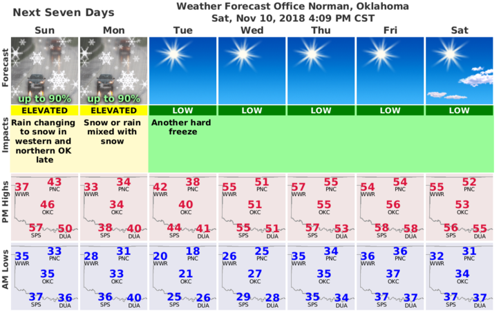
3- Here is your forecast from the NWS/NORMAN;
Veterans Day: 30 percent chance of showers after noon. Mostly cloudy, with a high near 46. Southeast wind 5 to 8 mph becoming north northeast in the afternoon.
Sunday Night: Snow. Low around 29. North wind 9 to 16 mph, with gusts as high as 23 mph. Chance of precipitation is 80%. New snow accumulation of around an inch possible.
4- I’ll update over the GARFIELD COUNTY EM app as needed and I may do a live broadcast later with any changes. Also, visit our website at gcem.org if you have time.
HAVE A SUPER DAY!!
MIKE