0345L-SUNDAY OUTLOOK AND INFO FROM GARFIELD COUNTY EMERGENCY MANAGEMENT-11/8/20
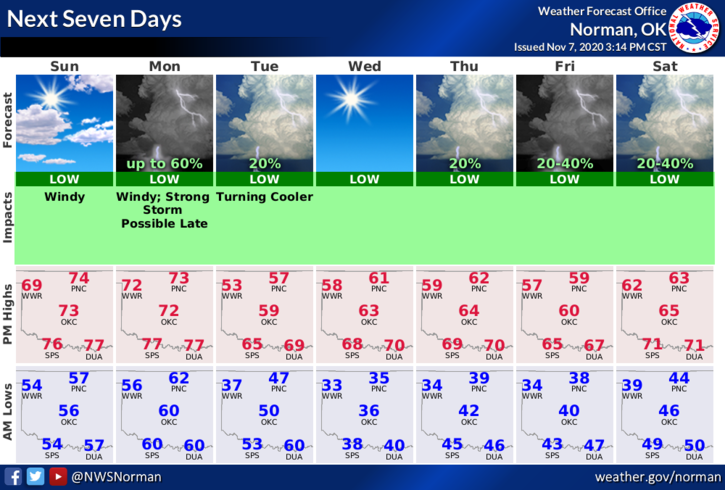
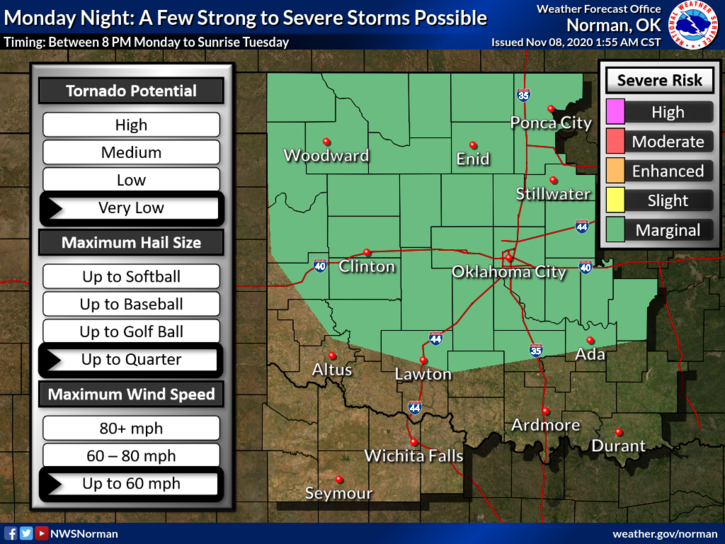
1- WARM AND WINDY today. Winds shouldn’t reach advisory parameters but it will be close at times per guidance. It will be very windy tonight and on Monday until the cold front pushes in early Tuesday morning. There will also be a chance for severe weather if conditions come together along and ahead of the front. I have attached graphics depicting this. We’ll see what happens.
2- Overall, we’ll be ok but beware of the winds and drive carefully as crosswinds may be strong at times. Here is your forecast from the NWS/NORMAN;
Sunday- Mostly sunny with a high near 74. Windy with a south southeast wind 15 to 25 mph, with gusts as high as 40 mph.
Sunday Night- Partly cloudy with a low around 60. South southeast wind 20 to 25 mph, with gusts as high as 30 mph.
3- We ask that anyone wanting to do any controlled burning today and tomorrow to please put that off until after the front pushes through. Humidity and dew points are a little higher but we are very dry and it wouldn’t take long for things to get out of control. If anyone sees smoke or fire, CALL 911.
HAVE A GOOD DAY!
MIKE