0335L-SUNDAY OUTLOOK FROM GARFIELD COUNTY EMERGENCY MANAGEMENT-10/30/22
PREPARED? DOWNLOAD “GARFIELD COUNTY EM and you’ll be better prepared.
1- Another mostly cloudy day in store for us as the large slow upper low departs the area. There will be a low chance for some precip this afternoon but shouldn’t amount to much. After today, we will start a warmup with southwesterly winds which will ramp up the fire danger again.
2- FIRE DANGER? YES. Even though we received some pretty good rainfall, it soaked in and foliage is dead and or is dying. All the rain does is make it tricky to get into areas and put the fire out. Use extreme caution while using anything related to fire. We are still in an EXTREME DROUGHT.
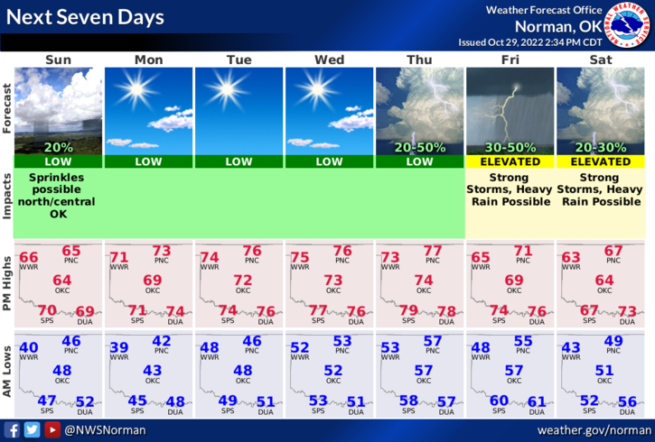
3- The above stated, we may have a chance for some strong thunderstorms later in the week. We’ll see what happens. Until then, here is your forecast from the NWS/NORMAN;
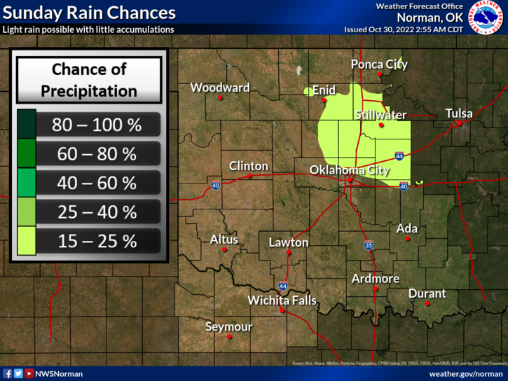
Today-Partly sunny this morning, then mostly cloudy with a slight chance of showers this afternoon. Highs in the mid-60s. North winds 5 to 10 mph. Chance of rain 20 percent.
Tonight-Mostly cloudy in the evening, then clearing. Lows in the lower 40s. Northwest winds 5 to 10 mph.
HAVE A GOOD DAY!