0425L-SUNDAY UPDATE FROM ENID/GARFIELD COUNTY EMERGENCY MANAGEMENT-10/7/18
STATEMENT- DO NOT ACCEPT A FRIEND REQUEST ON SOCIAL MEDIA FROM ME AS I DON’T REQUEST THOSE ANYMORE. DON’T SEND ME A FRIEND REQUEST SINCE I DON’T KNOW IF THEY ARE LEGITIMATE. “FOLLOW” MY PAGE IF YOU WOULD LIKE TOO. Way too much fraud going on. This is why we will have big changes soon. If you have questions, email me – mike@gcem.org
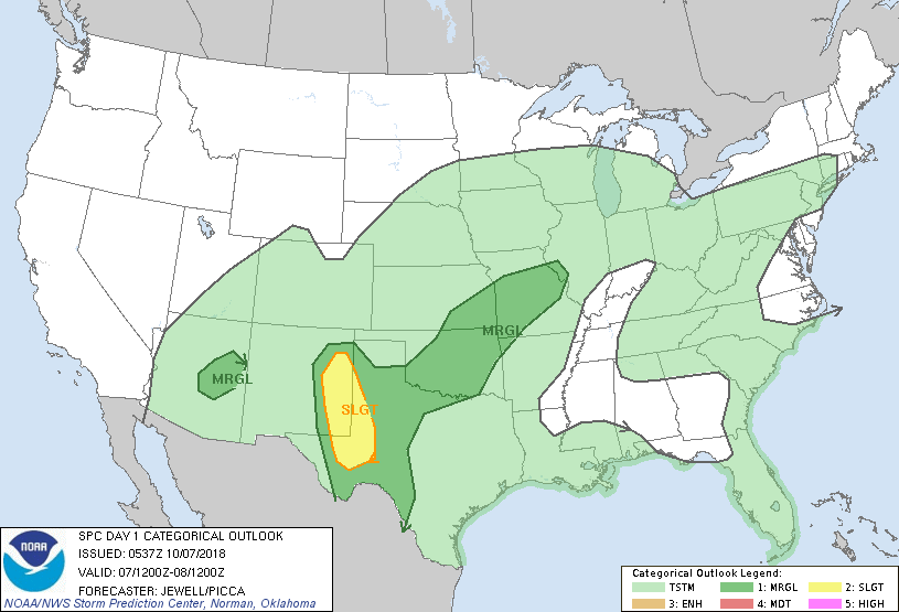
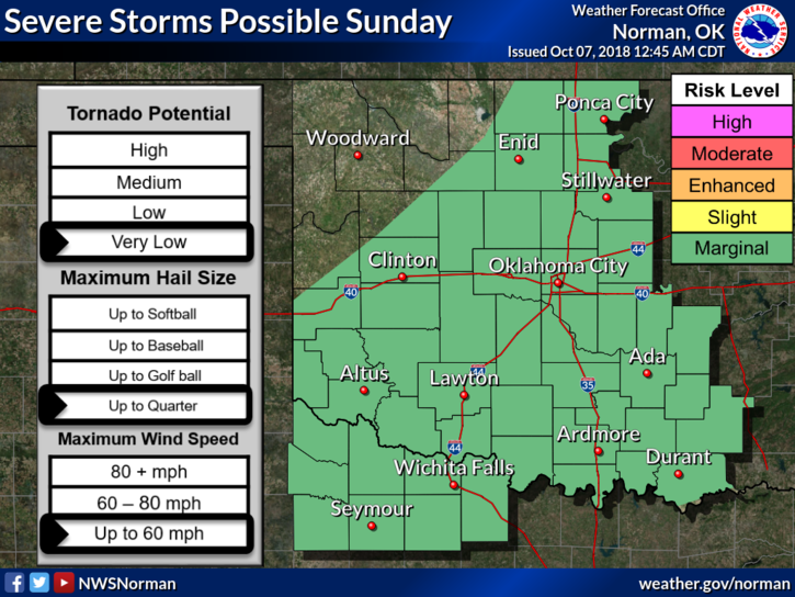
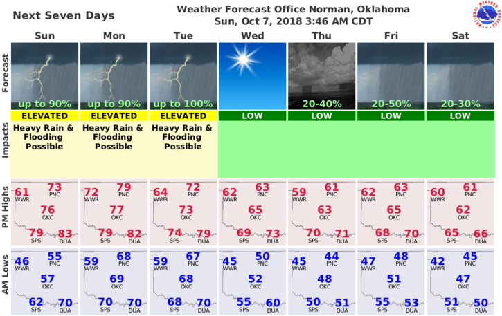
1-MARGINAL RISK FOR STORMS TODAY AND TONIGHT.
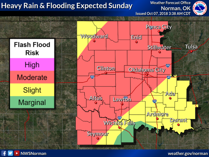
2- AREAL FLOOD WATCH IN EFFECT THROUGH TUESDAY-A FLOOD WATCH MEANS THERE IS A POTENTIAL FOR FLOODING BASED ON CURRENT FORECASTS.
3-IF YOU PLAN ON TRAVELING, MONITOR THE WEATHER CLOSELY.
4- WHILE DRIVING, DON’T DRIVE THROUGH RUSHING WATER- TURN AROUND, DON’T DROWN.
5- HERE IS YOUR FORECAST FROM THE NWS/NORMAN;
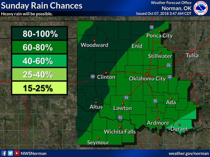
Sunday-Showers and possibly a thunderstorm. Some of the storms could produce heavy rainfall. High near 65. Northeast wind 5 to 7 mph becoming light and variable. Chance of precipitation is 80%. New rainfall amounts between a half and three quarters of an inch possible.
Sunday Night-Showers and possibly a thunderstorm. Some of the storms could produce heavy rainfall. Low around 64. South southeast wind 6 to 10 mph. Chance of precipitation is 80%. New rainfall amounts between 1 and 2 inches possible.
HAVE A GOOD DAY.
MIKE