0410L-THURSDAY OUTLOOK FROM GARFIELD COUNTY EMERGENCY MANAGEMENT-4/1/21
1- FREEZE WARNING IN EFFECT FROM 0300 UNTIL 0900 LOCAL TIME THIS MORNING. Temps have continued to drop this morning as colder air is moving in. Frost is a definite possibility and freezing temps are also a possibility. We’ll see how low we go!
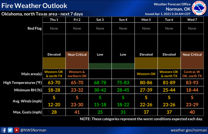
2- Overall for today, the Fire Danger will be elevated so be extremely careful using anything related to fire. If you see smoke and or fire, call 911. Friday will be a Near Critical Fire Weather day so just keep that in mind.
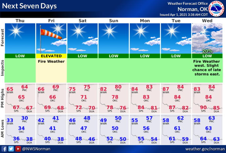
3- The weather looks to be warm and breezy over the next 4-5 days so get out and enjoy some sunshine. Here is your forecast from the NWS/NORMAN;
Today-Sunny. Highs in the mid-60s. Southeast winds up to 10 mph shifting to the south in the afternoon.
Tonight-Clear. Lows in the upper 30s. Southeast winds 10 to 15 mph.
4- Be sure to download our GARFIELD COUNTY EM app. Preparedness is your responsibility. Our app is the best thing to help you get there. It just might save your life!
HAVE A GREAT DAY!!
MIKE