0325L-THURSDAY OUTLOOK FROM GARFIELD COUNTY EMERGENCY MANAGEMENT- 4/24/25
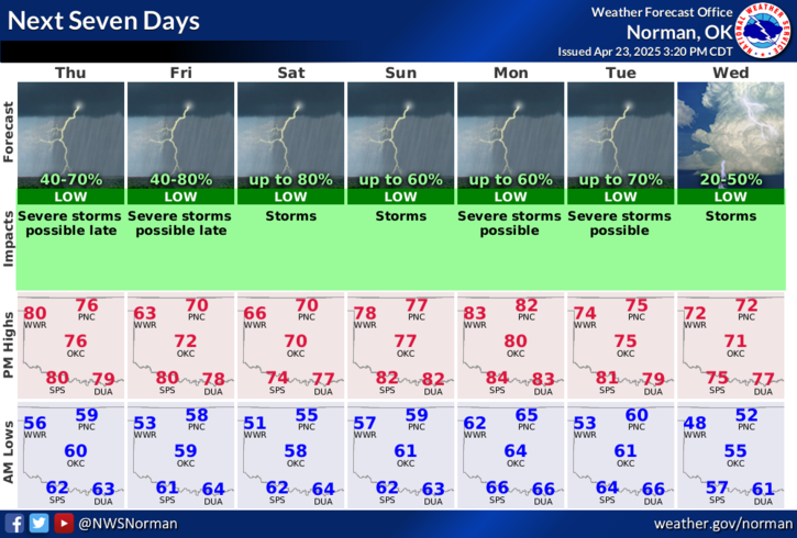
SLIGHT RISK for severe weather today with large hail and damaging winds as the main threats. At 0320L there are storms in south central Oklahoma moving east and there is a cluster of storms just north of Harper and Woods County moving east at 15mph. These might drop down and affect us over the next few hours. If they do, torrential rainfall and 1 inch hail can be expected. Another round later today into tonight is also possible.
If you need more information and would like to read additional discussions, the Storm Prediction Center web site and the Weather Prediction Center site can be found here along with a lot of other links- https://gcem.org/links/
Overall, we’ll be ok. Here is your forecast from the NWS/NORMAN:
Today- Mostly cloudy. A slight chance of showers and thunderstorms after midnight. Showers likely with a chance of thunderstorms. Highs in the mid-70s. Southeast winds 10 to 15 mph with gusts up to 25 mph. Chance of rain 70 percent.
Tonight-Thunderstorms likely. Showers. Lows in the upper 50s. Southeast winds 10 to 15 mph. Chance of rain 80 percent.
Be sure to download our GARFIELD COUNTY EM app. NWS warnings and advisories come through in detail automatically and you’ll get important info from us too.
STAY WEATHER AWARE AND WE’LL ADVISE AS NEEDED.
HAVE A GOOD DAY!