0330L-THURSDAY OUTLOOK FROM GARFIELD COUNTY EMERGENCY MANAGEMENT-4/28/22
1- Here is your forecast from the NWS/NORMAN;
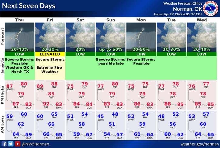
Today-Mostly cloudy. A chance of showers and thunderstorms this morning. Highs in the lower 80s. South winds 15 to 20 mph with gusts up to 30 mph. Chance of rain 50 percent.
Tonight-Partly cloudy. A slight chance of showers and thunderstorms in the evening. Lows in the mid-60s. South winds 15 to 20 mph with gusts up to 30 mph. Chance of rain 20 percent.
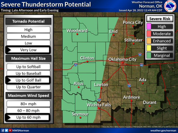
2- MARGINAL RISK FOR SEVERE WEATHER LATER THIS AFTERNOON. If storms do form and remain discreet, all hazards are possible. Many variables happening with the models so we won’t speculate. Just be prepared later today for storms firing just west, on top of us, or just east as they did last week.
3- This morning, we hopefully expect some showers and thunderstorms as this wave moves east. Gusty winds and heavy rainfall MIGHT occur. We’ll see what happens.
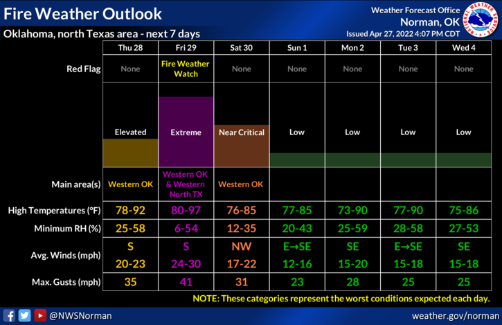
4- Some areas of the county are in an EXTREME DROUGHT and others in a SEVERE DROUGHT situation. The FIRE DANGER is critical today and may be higher tomorrow. Use extreme caution if utilizing anything related to fire. Call 911 if you see smoke and fire.
HAVE A GOOD DAY!