0325L-FRIDAY OUTLOOK FROM GARFIELD COUNTY EMERGENCY MANAGEMENT-4/29/22
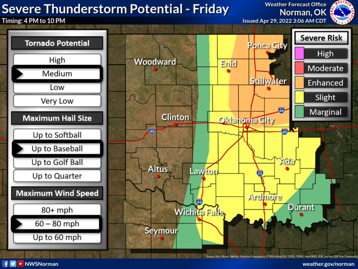
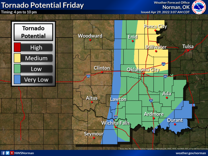
ENHANCED RISK FOR SEVERE WEATHER LATER TODAY-ALL HAZARDS MAY BE POSSIBLE.
1- WIND ADVISORY in effect from NOON TODAY until 8pm this evening.
2- Here is your forecast from the NWS/NORMAN;
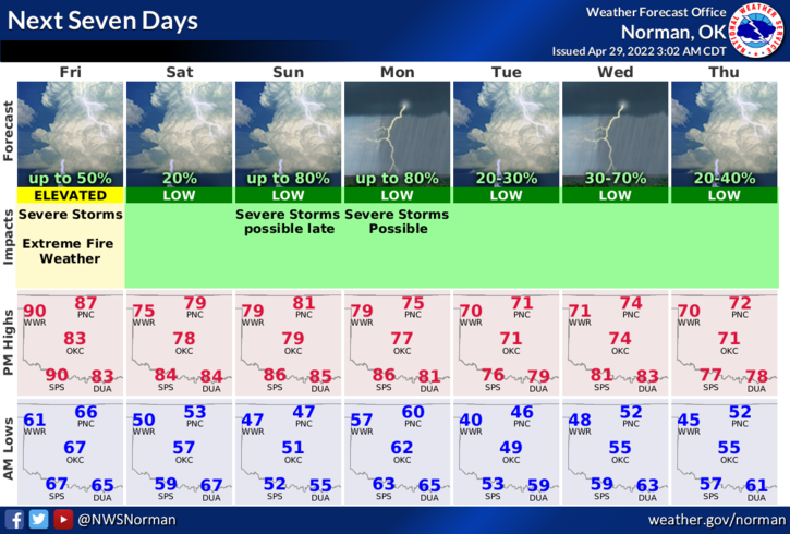
Today-Mostly sunny. A slight chance of showers and thunderstorms this afternoon. Windy with highs in the upper 80s. South winds 20 to 30 mph with gusts up to 50 mph. Chance of rain 20 percent.
Tonight-Partly cloudy with a slight chance of showers and thunderstorms in the evening, then mostly clear after midnight. Some thunderstorms may be severe. Windy and less humid with lows in the mid-50s. South winds 20 to 30 mph with gusts up to 45 mph, becoming west 10 to 15 mph with gusts up to 25 mph after midnight. Chance of rain 20 percent.
3- TWO SCENARIOS- 1-Storms will form along the dryline later today as it moves east and would be severe with All Hazards Possible. OR-2- The cap holds during the day and storms form along the cold front later this evening giving us a better chance for high winds and a lessor chance for large hail. The only problem would be the squall line that is called a Quasi-Lineal Convective System. This type of line can produce high winds, hail, and tornadoes. Unfortunately, this would occur after dark. If the dryline pushes on through, we may not see anything at all, even with the front. We’ll coordinate closely with the NWS and advise over social media and the GARFIELD COUNTY EM app. Today would be that day you need the app.
4- Pay close attention to what’s happening as the day progresses.
HAVE A GOOD DAY!