0400L-THURSDAY OUTLOOK & INFO FROM GARFIELD COUNTY EMERGENCY MGMT-4/9/2020
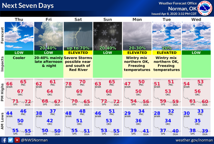
1- FREEZING TEMPS are the big story in the near future possibly starting Friday morning. Per guidance, we shouldn’t hit freezing Friday morning but we’ll be close. A wintry mix of rain and snow are possible later Sunday into Monday. We’ll most likely see a hard freeze Monday through Wednesday mornings. Hopefully large crops won’t be affected too much and make sure you cover up anything you have recently planted.
2-The above said, here is your forecast from the NWS/NORMAN;
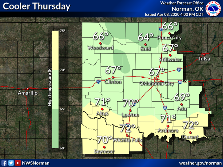
Today-Partly cloudy and cooler. Highs in the mid-60s. Northeast winds around 10 mph.
Tonight-Mostly clear and colder. Lows in the mid-30s. Northeast winds around 10 mph.
DIRECTOR’S COMMENT:
I have asked the Health Department to post additional information so many of you can do some more research on this virus and others. These will show up on the Enid/Garfield County Emergency Management page. Feel free to share this information and hopefully you will benefit from the additional information.
Speaking of malware, viruses, and FRAUD, I am getting bombarded with folks allegedly sending VIDEOS. I learned a long time ago NOT TO OPEN these since damage can occur to your computer or phone if the right malware or virus makes its way into your system. This is why I don’t use messenger. I also don’t monitor social media all day either. If anyone needs additional info concerning anything I post, contact me directly. If you have our GARFIELD COUNTY EM app, use the ASK THE DIRECTOR icon. Thank you all.
HAVE A SUPER DAY!!
MIKE