0245L-THURSDAY OUTLOOK FROM GARFIELD COUNTY EMERGENCY MANAGEMENT-8/12/21
IMPORTANT INFORMATION: If you can’t find our daily info here on social media, you can find it under GCEM BLOG on our GARFIELD COUNTY EM app. You can also go to OUR WEBSITE at www.gcem.org and get the same information right there on the front page. I am reminding you of this because you will need options in the future as things change on social media venues. More on this at a later time.
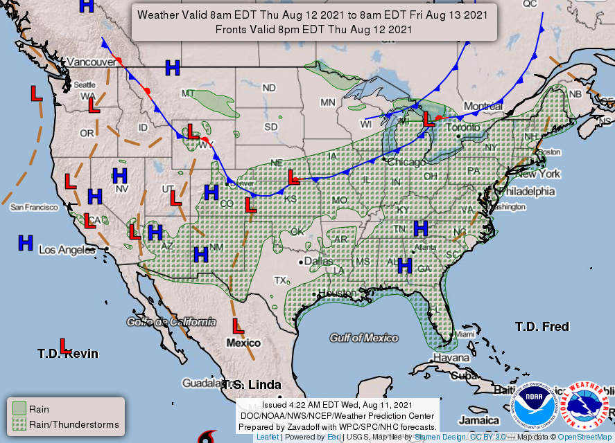
1-Hot and breezy today with heat index values lower than yesterday. Heat advisory criteria will probably not be met. We are expecting showers and thunderstorms possibly in NW Oklahoma later tonight as a weak front attempts to push in.
2- For the weekend, we do stand a chance for rain. If storms occur, per guidance, the forecast will be more sensitive to mesoscale processes meaning that depending on where outflow boundaries end up is where storms may form. This will be similar to recent rainfall events. We’ll see what happens.
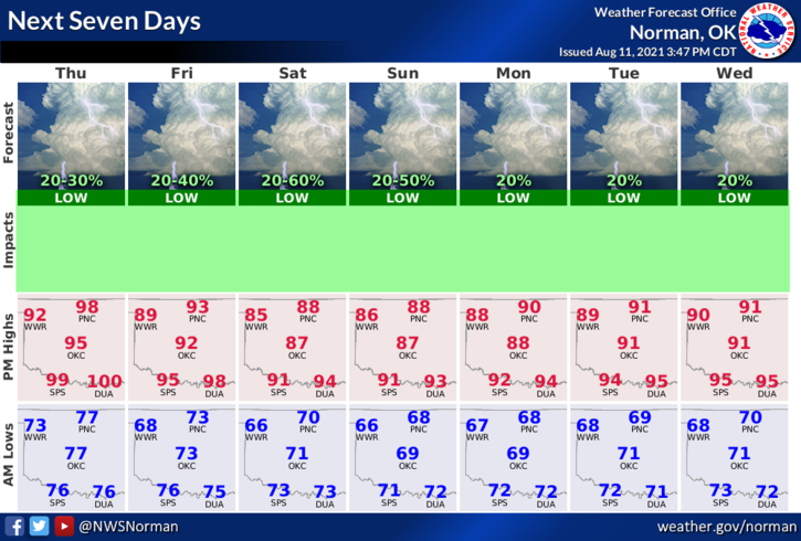
3- Overall, we’ll be ok. Here is your forecast from the NWS/NORMAN;
Today-Mostly sunny and hot, with a high near 98. Heat index values as high as 101. South southwest wind 11 to 16 mph, with gusts as high as 23 mph.
Tonight-20 percent chance of showers and thunderstorms after 1am. Partly cloudy, with a low around 71. Southeast wind 8 to 15 mph, with gusts as high as 21 mph.
HAVE A GOOD DAY!!
MIKE