0325L-WEDNESDAY OUTLOOK FROM GARFIELD COUNTY EMERGENCY MANAGEMENT-8/11/21
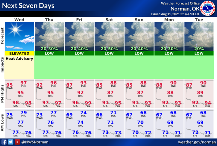
1- “HEAT ADVISORY” CONTINUES FROM NOON UNTIL 8PM. Continue to use caution while working outdoors. Thursday, we expect a front to push in giving us a chance for a little bit of cooler weather and possibly thunderstorms. The unfortunate thing here is that thunderstorm chances will continue into this weekend and next week.
2-Look at this as a good thing. If it was wintertime right now with high humidity and we were under northwest flow, we could be seeing a major snow or ice event, and depending on temperature with the wind, very low wind chill temps. For now, I’ll take the heat.
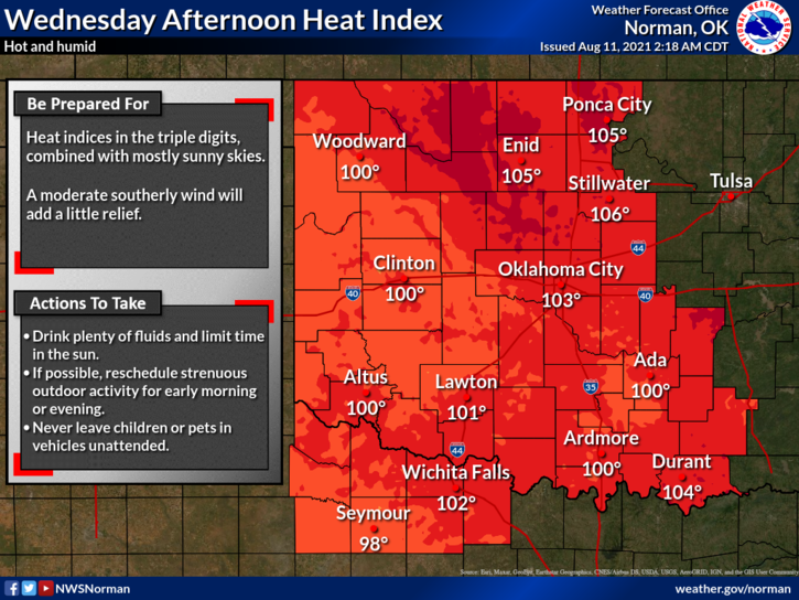
3- Here is your forecast from the NWS/NORMAN;
Wednesday-Mostly sunny and hot, with a high near 98. Heat index values as high as 103. South southwest wind 10 to 20 mph, with gusts as high as 25 mph.
Wednesday Night-Partly cloudy, with a low around 75. South wind 15 to 20 mph decreasing to 10 to 15 mph in the evening. Winds could gust as high as 28 mph.
STAY COOL AND HAVE A GOOD DAY!!
MIKE