0355L-THURSDAY UPDATE FROM ENID/GARFIELD COUNTY EMERGENCY MANAGEMENT-8/16/18
1-We are in a SLIGHT RISK for severe weather later today into tonight and overnight. After reading the discussions this morning, let me just say, it’s a very complicated mess out there. The past few days of rain, moisture both on the surface and aloft, a potential weak cold front basically means we’ll most likely have storms later today. Timing is an issue and where everything may fire won’t be known for sure until later today. This will be updated when the forecast becomes a bit more firm.
2- Make sure you have our GARFIELD COUNTY EM app as that is where the update will come from later today. The app reaches more folks than Facebook with all of the choking back of information they are doing so keep this in mind. Future important information will come through our app first. Additional information will be forthcoming in future posts on what’s going on.
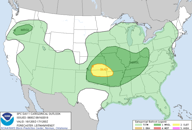
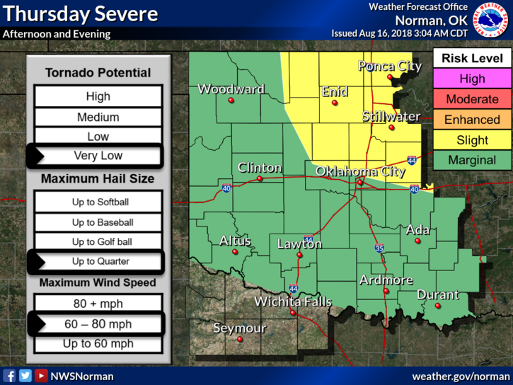
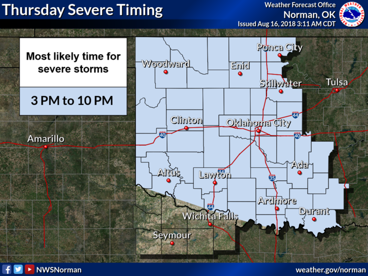
3- All this said, There may be storms later today. IF WE DO HAVE STORMS, “RISKS ARE” per the graph attached. See below. Please take the time to study the graph.
4- Here is your forecast from the NWS/NORMAN;
Today-Partly cloudy. A slight chance of showers late in the morning. A chance of thunderstorms in the afternoon. Highs in the upper 80s. South winds around 10 mph. Chance of precipitation 30 percent.
Tonight-Partly cloudy. A chance of thunderstorms in the evening, then a slight chance of thunderstorms after midnight. Lows in the lower 70s. South winds around 10 mph. Chance of thunderstorms 30 percent.
HAVE A GOOD DAY!!
MIKE