0350L-THURSDAY OUTLOOK FROM GARFIELD COUNTY EMERGENCY MANAGEMENT-12/09/21
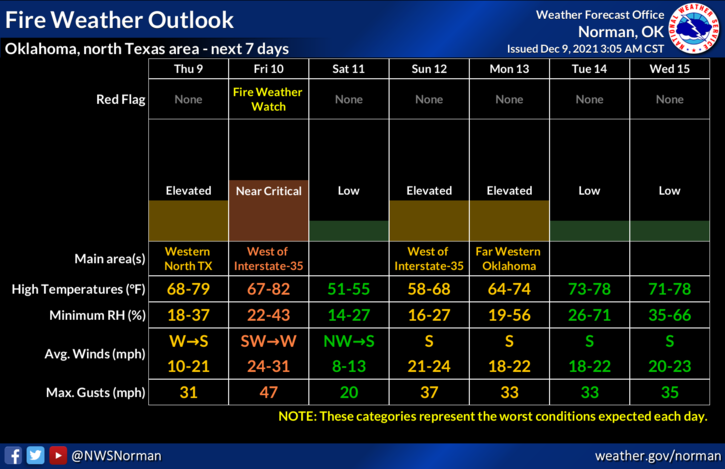
1- Another warm day with a weak front that will push in later this morning or early afternoon. No precip expected and then tomorrow we will be in a Fire weather Watch which may likely become a RED FLAG WARNING. We’ll have to wait and see how conditions develop.
2-I know some don’t care about the fire weather situation but we as firefighters, especially in the rural community, do watch this very carefully. Strong winds, low humidity, low dew point temps, and our Moderate Drought Situation adds to the problem. Winds, along with the different types of terrain we have here in the county will make it extremely difficult to bring any fire that starts under control quickly. This is why I always state, if you see smoke or fire, call 911 immediately. I’ll just ask that ANY controlled burning that occurs today be completely out by dark tonight then no burning at all tomorrow. Thank you!!
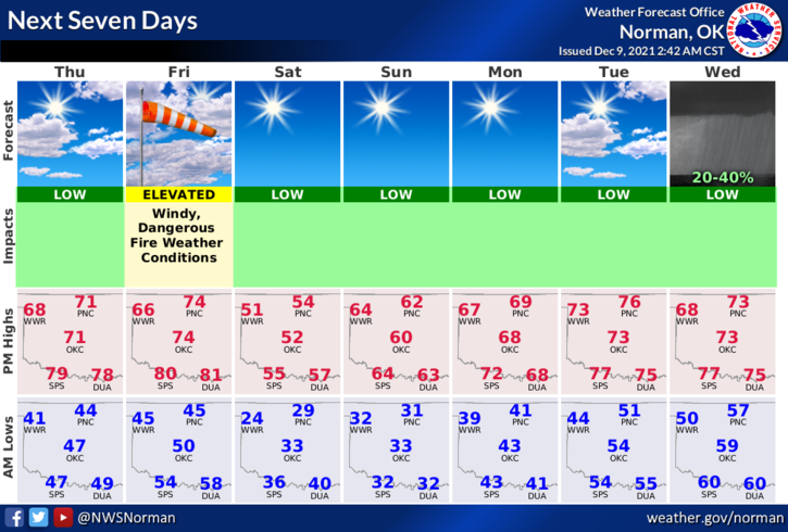
3- All that said, we’ll be ok so here is your forecast from the NWS/NORMAN;
Today-Sunny, warmer. Highs in the lower 70s. West winds around 10 mph in the morning becoming light and variable.
Tonight-Mostly clear. Lows in the lower 40s. Light and variable winds becoming south around 10 mph after midnight.
STAY SAFE!