0405L-THURSDAY OUTLOOK FROM ENID/GARFIELD COUNTY EMERGENCY MANAGEMENT-12/27/18
1-We survived all of the rain. I received 1.75 inches. Let me know how much you received. Those of you that have our GARFIELD COUNTY EM app, send me a DAMAGE REPORT. I want to see how you like that feature. Thank you!!
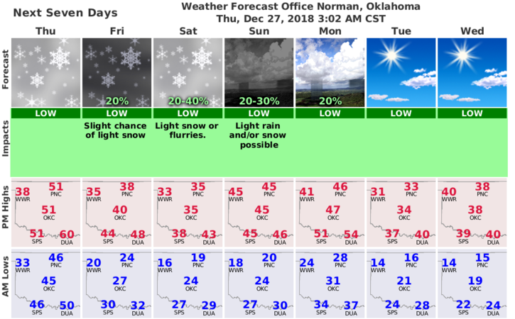
2-We’ll slowly be getting cooler starting later this morning so just keep in mind that you may need a jacket later today and probably for the rest of the year. We’ll see the sun, then clouds, then MAYBE EVEN a snowflake or two as we move through the weekend but nothing major, at least right now.
3- Here is your forecast from the NWS/NORMAN;
Thursday- Increasing clouds, with a temperature rising to near 48 by 10am, then falling to around 35 during the remainder of the day. South wind 15 to 25 mph becoming northwest in the afternoon. Winds could gust as high as 35 mph.
Thursday Night- Mostly clear, with a low around 25. Northwest wind 10 to 15 mph, with gusts as high as 25 mph.
4- FINALLY, today and tomorrow are officially designated as PANT DAYS due to the winds.
HAVE A SUPER DAY AND STAY SAFE!!
MIKE