0410L-THURSDAY OUTLOOK & INFO FROM GARFIELD COUNTY EMERGENCY MANAGEMENT-2/21/19
1- Today will start out cloudy and hopefully become partly cloudy as the day wears on. Not expecting any precip here today and the rest of what little snow we received should be history unless there is some on the north side of your property where the sun doesn’t reach yet.
2- Tomorrow, we’ll have a chance for a thunderstorm or two if things come together just right. The severe threat should be in SE Oklahoma but we’ll see what happens as a front will intercept a dryline and move across the area Friday evening and overnight.
3) That said, the media can really hype stuff up way out of proportion sometimes, well maybe a lot!! Get our GARFIELD COUNTY EM app and you’ll get NO-HYPE info that you can use to stay advised on what is going on or going to happen. If you ever see this- kowhdxq hehd66r 2hyqwbxKV YBWBCKGCK WCKWBK65444 or something similar YOU SHOULD PANIC as this shows that I am panicked. If I don’t panic, you shouldn’t either. Just so you know the code to panic!!
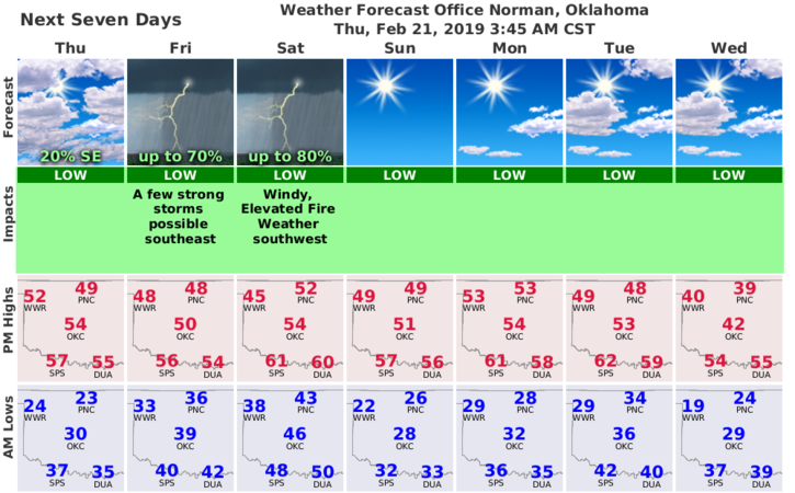
4) Here is your forecast from the NWS/NORMAN;
Today- Decreasing clouds. Highs in the upper 40s with Southeast winds 10 to 15 mph.
Tonight- Partly cloudy. Lows in the mid-30s with Southeast winds around 10 mph.
HAVE A SUPER DAY!!
MIKE