0300L-THURSDAY OUTLOOK FROM GARFIELD COUNTY EMERGENCY MANAGEMENT-2/25/21
1- Nice day on tap except for those pesky winds. Wind is needed to dry things out so we’ll just deal with it. Today, with temps in the 50s and NE winds you can find warmth on the west side of most buildings and enjoy the sun this afternoon. There is a possibility for rain late so we may have clouds move in during the day and evening hours. If we do see some thunderstorms later tonight, we don’t expect anything severe, at least as I type.
2- Speaking of storms, be sure to download our emergency notification app-GARFIELD COUNTY EM. Preparedness is something EVERYONE should do so you have some sort of idea what you will do in the event of something happening. Many were not prepared for the winter blast we had so do your best to be prepared for the up and coming storm season. KEY WORDS here are BE PREPARED, NOT SCARED.
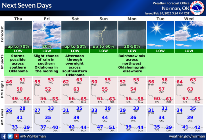
3- Here is your forecast for Thursday from the NWS/NORMAN;
Thursday-Mostly sunny. Highs in the lower 50s. Northeast winds 10 to 15 mph gusting to 21 mph.
Thursday Night- Partly cloudy with a 20 percent chance of rain showers. Lows in the lower 30s. East winds around 10 mph in the evening becoming light and variable.
HAVE A GOOD DAY!
MIKE