0400L-WEDNESDAY OUTLOOK FROM GARFIELD COUNTY EMERGENCY MANAGEMENT-2/24/21
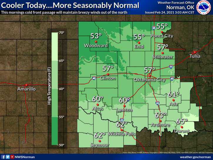
1- Windy and cooler after a cold front moved through during the overnight hours. Winds will remain gusty all day. Temps will be somewhere in the 50s with some wind gusts around 30 mph. We have already had some gusts to 46 mph.
2- I haven’t mentioned anything lately about the FIRE DANGER. Even though we received a lot of snow, surface grasses and other plants are still dead and pose a viable fire probability. Be extremely careful utilizing anything concerning fire and if you see smoke and or fire, call 911 immediately so the proper response can be dispatched.
3- Each Wednesday we test our GARFIELD COUNTY EM app between 1130 and 1300 (1pm) local time. You may have noticed now that it comes with a different tone. I set different tones for alerts from us to the public, our responders countywide, and for the NWS. We do this so you know something is going on. We just want you to know that if we send either information or a warning, it’s something that you need to pay attention too. Download it today. Not only will it provide you with preparedness information, but it just might also save your life!
Here is your forecast from the NWS/NORMAN;
Wednesday-Sunny with a high near 55. North wind 15 to 20 mph gusting to 30 mph.
Wednesday Night-Partly cloudy with a low around 29. North northeast wind around 10 mph.
HAVE A GOOD DAY!!
MIKE