0355L-THURSDAY WEATHER UPDATE FROM GARFIELD COUNTY EMERGENCY MANAGEMENT
WINTER WEATHER ADVISORY IN EFFECT FOR HARPER, WOODS, AND ALFALFA COUNTIES UNTIL NOON. SNOW AND BLOWING SNOW WITH HIGH WIND GUSTS ARE POSSIBLE. If you plan on traveling, make sure you are prepared.
The WIND ADVISORY goes into effect at 6am this morning until 9pm tonight. Wind gusts could be severe so again, be careful when driving. GARFIELD COUNTY IS INCLUDED!
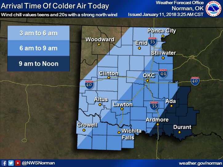
The most IMPORTANT issues we’ll face today are the WINDS AND “POSSIBLY” SNOW. Sustained winds will average in the mid to upper 20’s with higher gusts. IF it snows or even sleets a little, bridges and overpasses COULD be a bit touchy. SLOW DOWN. There isn’t anything going on that requires having an accident on the way.
Here is your forecast and it will change some from the NWS/NORMAN;
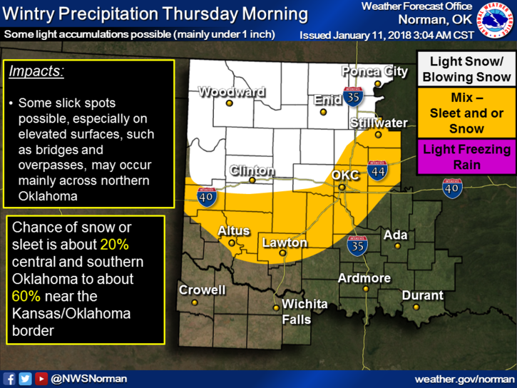
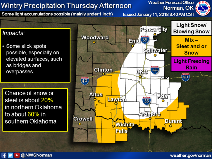
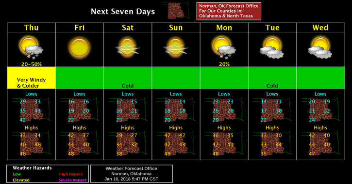
Thursday- chance of rain and snow before noon. Cloudy, then gradually becoming mostly sunny, with temperatures falling to around 27 by 9am. Windy with north wind 23 to 28 mph, with gusts as high as 40 mph. Chance of precipitation is 40%. Little or no snow accumulation expected.
Thursday Night-Mostly clear, with a low around 15. North wind 16 to 21 mph decreasing to 8 to 13 mph after midnight. Winds could gust as high as 29 mph.
STAY SAFE AND WE’LL ADVISE AS NEEDED.
MIKE