0420L-THURSDAY OUTLOOK & INFO FROM GARFIELD COUNTY EMERGENCY MGMT-1/16/2020
1- WINTER WEATHER ADVISORY IN EFFECT FROM 6 AM TODAY UNTIL 6 AM FRIDAY MORNING. Some of these areas may change between now and then. Keep up with the latest from the NWS and GCEM.
2- Dynamics in the atmosphere have to come together just right for the various winter types to occur. NO ONE can predict exactly where these things will occur. This is why maps are set up to give you an idea on where things MIGHT occur. If you plan to travel, check conditions closely and remember that the trip there might me great, but the trip home may add a motel stay somewhere. Travel smart!!
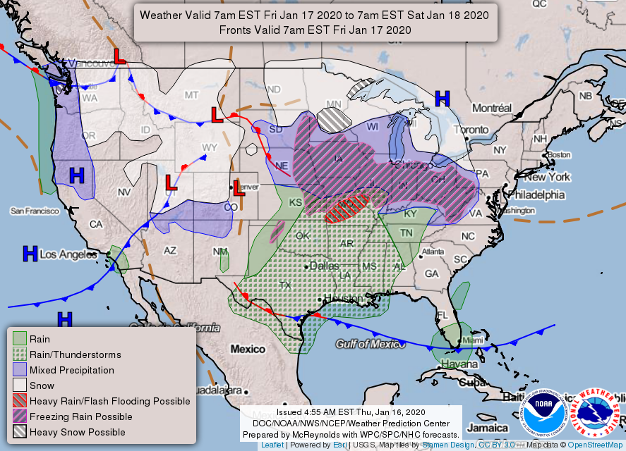
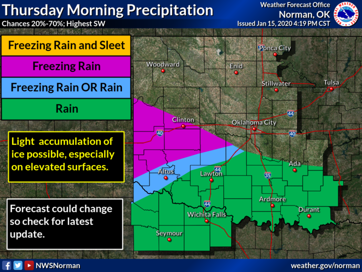
3- I will add a few NWS GRAPHICS but you can see them all at https://www.weather.gov/oun/
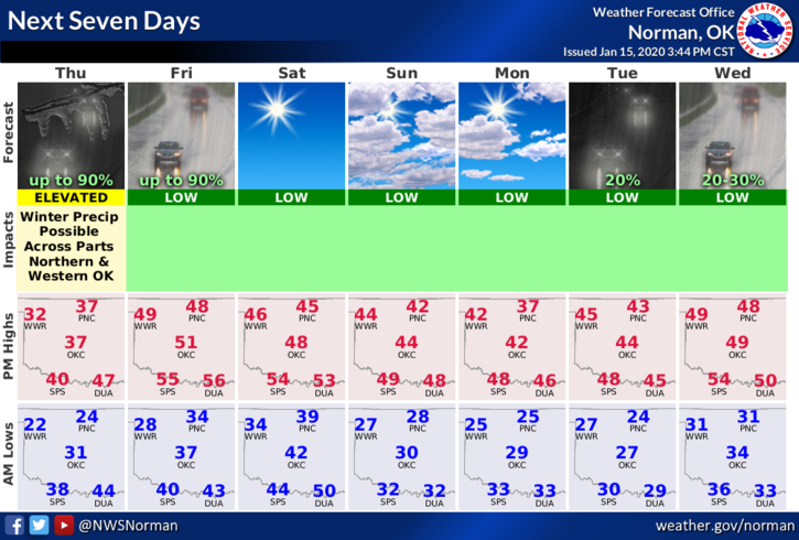
4- Here is your forecast from the NWS/NORMAN;
Today-A chance of rain or freezing rain, mainly after 3pm. Cloudy, with a high near 36. Northeast wind 10 to 13 mph. Chance of precipitation is 40%.
Tonight-Rain. Low around 32. East wind 7 to 9 mph. Chance of precipitation is 90%. New precipitation amounts between a half and three quarters of an inch possible.
HAVE A GOOD DAY!!
MIKE