0425L-THURSDAY OUTLOOK AND INFO FROM GARFIELD COUNTY EMERGENCY MANAGEMENT-7/4/19
GARFIELD COUNTY EM is our emergency app. You’re better prepared with it, than without it.
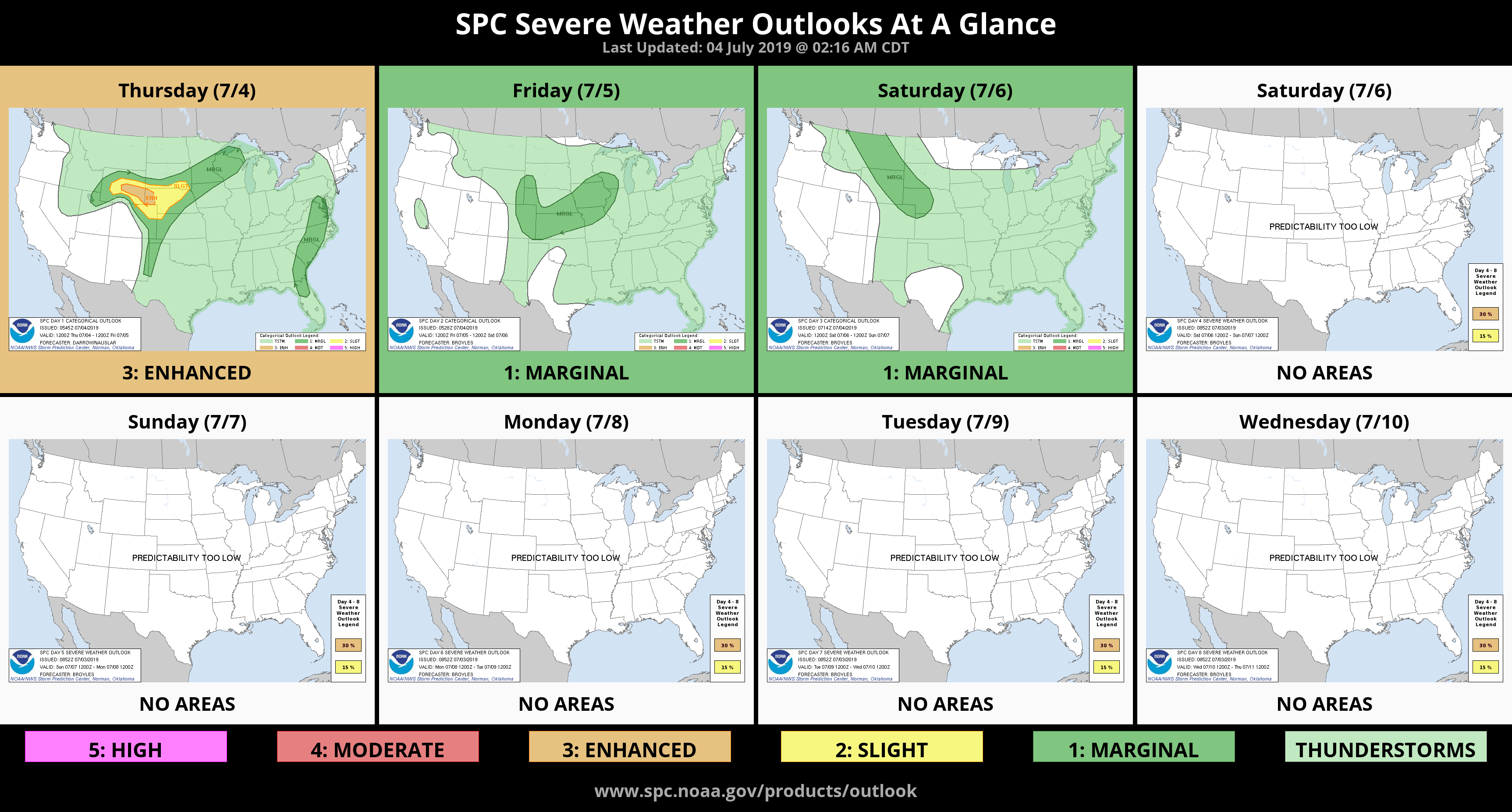
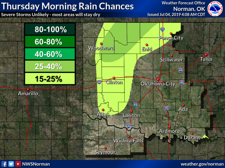
1- We are in a GENERAL THUNDERSTORM RISK area once again today. If storms occur, we are not expecting severe weather but as the last 2 days have dictated, the winds within many of these cells didn’t want to cooperate with that statement. Flash flooding, torrential rainfall, lightning, strong winds, and hail will be the main threats. Thunderstorms could occur as early as this morning and if they do, hopefully they take the energy with them as they move E-N-E.
2- Some areas of the county have not seen any rain the last few days and it’s extremely dry. Shooting off fireworks in those areas will be extremely dangerous so here is a REMINDER: Shooting off fireworks on county roads is illegal. Get permission from a landowner if you just have to go out and fire them off. Thank you.
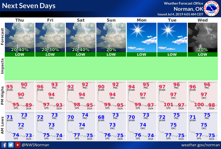
3-Here is your forecast from the NWS/NORMAN;
Today-Partly cloudy. A slight chance of thunderstorms early this morning. Highs in the mid-90s. South winds 10 to 15 mph. Chance of thunderstorms 20 percent.
Tonight- Mostly clear with lows in the lower 70’s. South winds 10 to 15 mph.
HAVE A GREAT DAY!
MIKE