0320L-THURSDAY OUTLOOK FROM GARFIELD COUNTY EMERGENCY MANAGEMENT 05/02/24
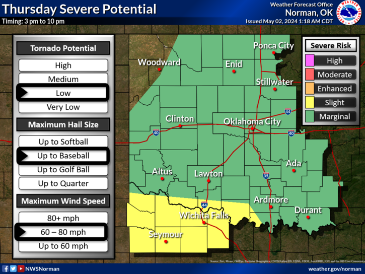
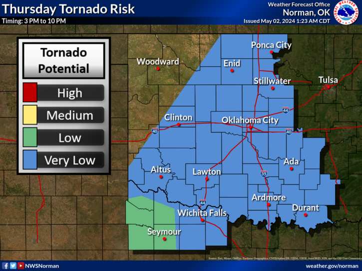
*A cold front will be pushing into the area in the early part of the afternoon bringing a chance for thunderstorms. We are in a MARGINAL RISK for some severe thunderstorms so we’ll wait and see what occurs as this front pushes into the area.
*The winds we are receiving right now 0310L are because of a WAKE LOW that formed from the activity to our south. Winds will remain gusty as this system moves off to the east.
*Overall, for today, there is a chance for thunderstorms here in the area but a higher risk will occur to our south. If traveling, keep up with the latest from the NWS/NORMAN or the nearest NWS WFO where you are going.
*Here is your forecast from the NWS/NORMAN;
Today- Showers likely with a chance of thunderstorms this morning, then showers with thunderstorms likely this afternoon. Highs in the mid-70s. Southwest winds 5 to 10 mph, becoming northwest 10 to 15 mph this afternoon. Chance of rain 90 percent.
Tonight- Mostly cloudy. A slight chance of showers and thunderstorms in the evening. Lows in the mid-50s. North winds 5 to 10 mph. Chance of rain 20 percent.
Be sure to download our GARFIELD COUNTY EM app so you can keep up with the latest from us and the NWS.
HAVE A GOOD DAY!