0325L-WEDNESDAY OUTLOOK FROM GARFIELD COUNTY EMERGENCY MANAGEMENT 05/01/24
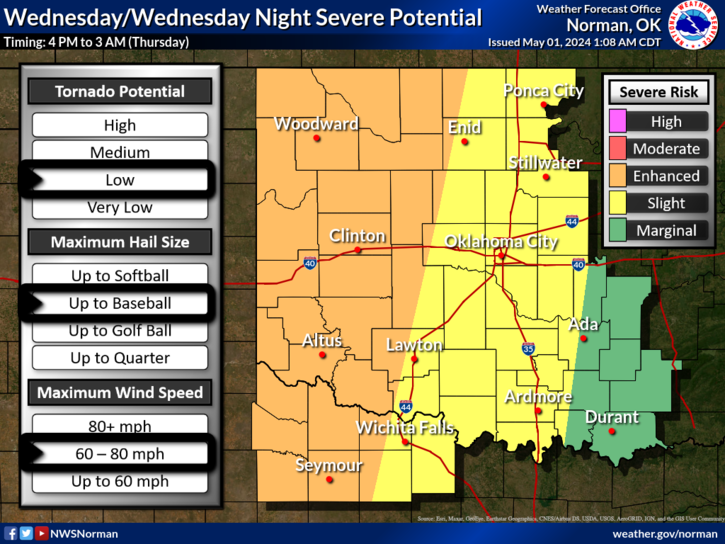
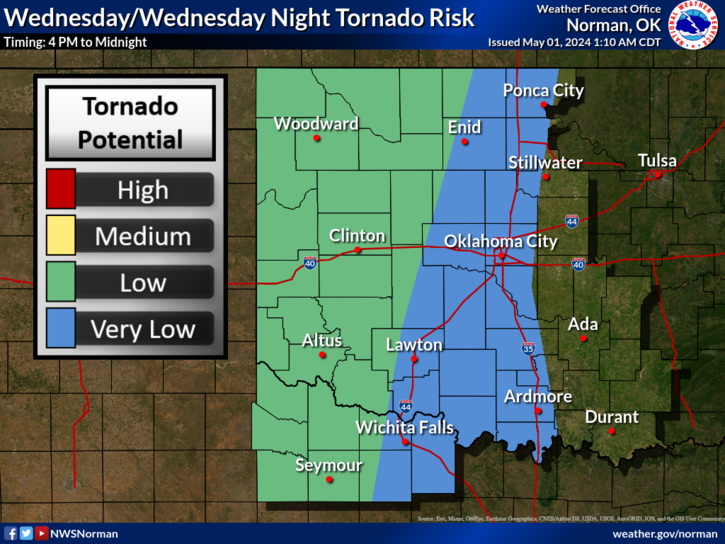
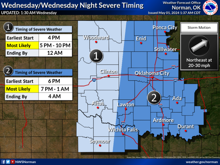
*SEVERE THUNDERSTORM WATCH in effect until 0500 Local time. FLOOD WATCH until 10am. We’ve had several rounds of thunderstorms and a few severe overnight but overall, some much needed rainfall. Today, we are in an ENHANCED/SLIGHT RISK area for severe weather later today. ALL HAZARDS ARE POSSIBLE. Winds to 80 mph, Baseball size hail, and a low chance for tornadoes. We will be watching this closely throughout the day. Timing for later today will be from 7pm until 1 am, give or take.
*The above said, you have read the details so just make sure things around the house are secure and we’ll do our best to keep you up to date utilizing live updates. NWS warnings, etc, automatically come over the GARFIELD COUNTY EM app so we don’t have to try to duplicate that.
*The graphics attached will change some as the day wears on so when they update, we’ll get them posted as quickly as possible.
*Overall, we’ll be ok so here is your forecast from the NWS/NORMAN;
Today-Partly sunny with a chance of showers and thunderstorms. Some thunderstorms may produce heavy rainfall this morning. Highs in the lower 80s. Southeast winds 15 to 20 mph with gusts up to 35 mph. Chance of rain 50 percent.
Tonight- Mostly cloudy with a chance of showers and thunderstorms. Lows in the lower 60s. South winds 15 to 20 mph with gusts up to 35 mph. Chance of rain 40 percent.
HAVE A GOOD DAY!