0340L-FRIDAY OUTLOOK FROM GARFIELD COUNTY EMERGENCY MANAGEMENT-5/28/21
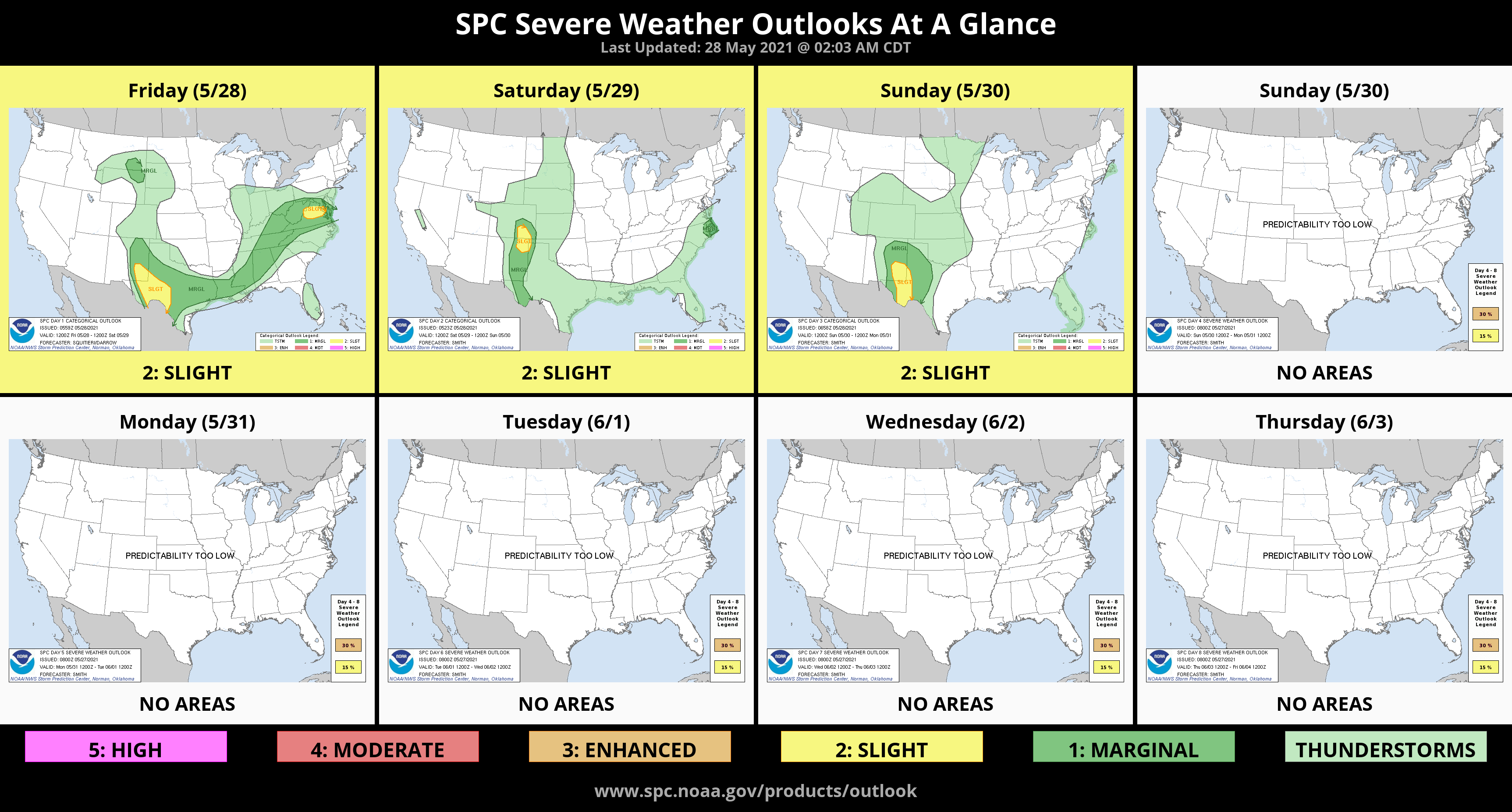
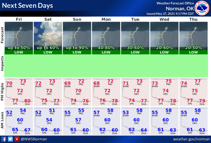
1- No thunderstorm risk for our area today but we do have rain and thunderstorm chances back in the forecast starting Saturday evening through the next 7 days. This said, there are a few flood watches and warnings around the region so if you plan on traveling, pay attention to road signs that may depict a flood issue. Your life could depend on it.
2-After I post on social media in any form, some folks ask questions. I don’t stay on social media after posting so if you have questions, ask them through our GARFIELD COUNTY EM app. There is an ASK THE DIRECTOR icon on our app and that comes directly to me. I will answer as soon as I can. When we are in operations, time is something we sometimes don’t have. We’re just a touch busy and yesterday, we were short-handed. That’s just the way it is sometimes.
3-Another thing, many folks complained that there were countless warnings yesterday and the app was going crazy. Each storm out there came with it’s own warning. That was because parameters in those storms were different. If you don’t want to get the warnings, go to settings, then notification settings, then find NOAA weather alerts and turn it off. Just don’t complain when you forget to turn it back on when we have storms a few days later.
4- Finally, I will try to do a video to show you how the app works in the near future. Most folks download it the day of the storm and get mad because they can’t find this or that. That’s how it works concerning preparedness. Most wait until the day of a storm and then panic because they weren’t ready. Just remember that PREPAREDNESS=RESILIENCE.
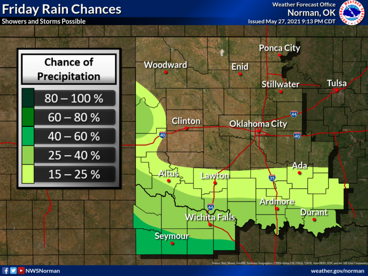
Here is your forecast from the NWS/NORMAN;
Friday-Partly cloudy. Cooler. Highs in the lower 70s. Northeast winds 10 to 15 mph.
Friday Night-Mostly clear. Lows in the lower 50s. East winds around 10 mph in the evening becoming light and variable.
HAVE A GREAT DAY!
MIKE