0400L-THURSDAY OUTLOOK FROM GARFIELD COUNTY EMERGENCY MANAGEMENT-5/6/21
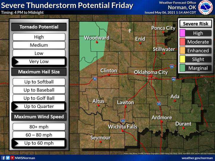
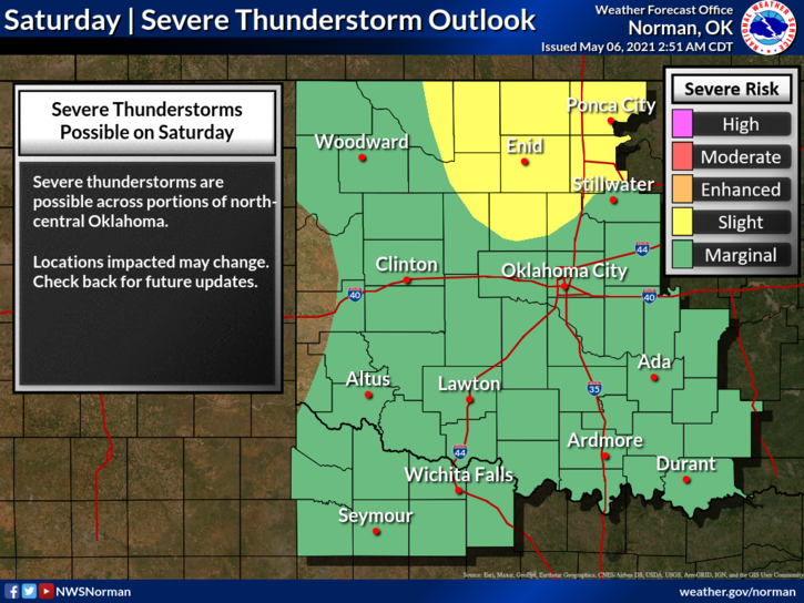
1- No storms today. Winds should become northerly with gusts around 15 mph while staying mostly clear. Thunderstorms come back into the forecast for a low chance Friday morning and then a higher chance for Friday night into Saturday with a slight risk. The risk level may become higher depending on model guidance. We’ll see what happens for sure as we move closer to the weekend.
2- Chances for rain continue through at least the middle of next week and temps will be holding in the 60-70 range after Saturday where we could see highs in the 80s.
3- Overall, we’ll be ok so here is your forecast from the NWS/NORMAN;
Thursday-Sunny, with a high near 74. West northwest wind 5 to 15 mph becoming north in the afternoon.
Thursday Night-Mostly clear, with a low around 48. Northeast wind 5 to 10 mph becoming southeast after midnight.
Finally, See fire? Call 911. Texting and driving? STOP and pay attention or someone may be calling 911. Drinking and driving? DON’T as someone may call 911 and your life possibly changes forever.
HAVE A GOOD DAY!
MIKE