0400L-THURSDAY OUTLOOK & INFO FROM GARFIELD COUNTY EMERGENCY MANAGEMENT-11/7/19
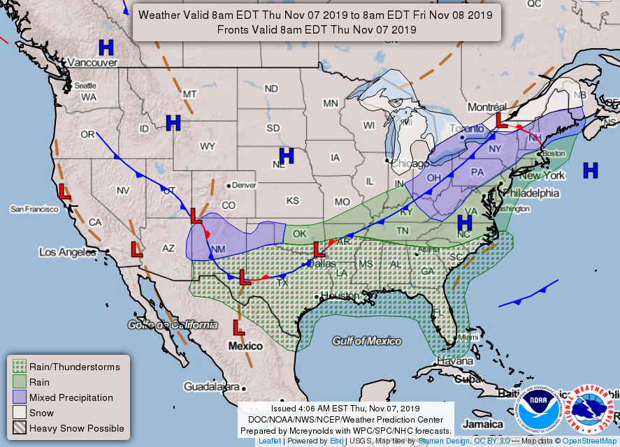
WINTER WEATHER ADVISORY IN EFFECT UNTIL NOON for HARPER, WOODS, ELLIS, WOODWARD, MAJOR, ROGER MILLS, DEWEY, CUSTER AND BECKHAM COUNTIES. If you plan on traveling, check the forecast here and at your destination.
1-As of 0330 local time we continue to receive light rain/drizzle. We are in the mid-30s and temps are expected to drop a little more by dawn. There is a slight chance we may see some light freezing drizzle and possibly a sleet/snow mix but little accumulation is expected. Just BE CAREFUL ON ELEVATED SURFACES.
2- Warmer weather will occur Friday through early Sunday then the bottom appears to fall out with an Arctic front arriving late Sunday. Bitter cold will occur with very low wind chills. You need to take cold weather precautions over the weekend before this next front gets here.
3- Overall, we’ll be ok and after this mess moves out, we’ll see a nice warmup. Get ready for winter once again!! Here is your forecast from the NWS/NORMAN;
Today-Cloudy with a chance of rain and light freezing rain early in the morning. Partly cloudy in the afternoon. Much colder. Highs in the lower 40s. North winds 20 to 25 mph decreasing to 10 to 20 mph in the afternoon. Chance of precipitation 50 percent.
Tonight-Clear. Lows in the mid-20s. Northeast winds around 10 mph in the evening becoming light and variable.
HAVE A GOOD DAY!!
MIKE