0355L-THURSDAY OUTLOOK FROM GARFIELD COUNTY EMERGENCY MANAGEMENT-9/17/2020
1-Warm days, cool nights and no rain in the forecast for the foreseeable future. What will become very real will be the fire danger as we dry out. Please be careful out there and report any smoke or fire to 911.
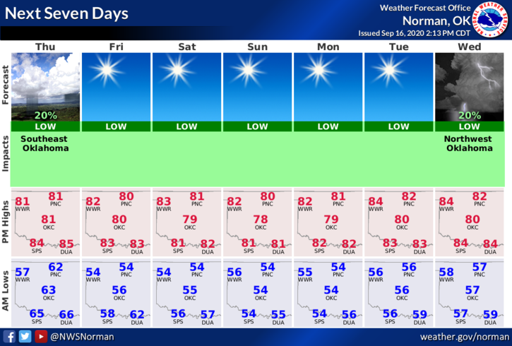
2- Here is your forecast from the NWS/NORMAN;
Thursday-Mostly sunny. Highs in the lower 80s. Northeast winds around 10 mph.
Thursday Night-Clear. Lows in the lower 50s. Northeast winds around 10 mph in the evening becoming light and variable.
3- Winter will be coming over the next several months. ARE YOU PREPARED? Here are a few questions you should ask yourself on how well you should be prepared.
A- If the NWS forecast stated THUNDERSTORMS would occur over the top of a shallow layer of below freezing air, what does this tell you and are you prepared for this?
B- If we had another devastating ice storm as we did in the early 2000’s, what would you do differently this time than last time to be prepared?
C- Finally, if we told you to stay home as road conditions were extremely dangerous and would get worse, how many of you would attempt to take your trip anyway?
All of these are questions you should have answers for and if you don’t, seek them out and slowly get prepared for what could be a colder and wetter winter than in the recent past.
HAVE A GOOD DAY!!
MIKE