0315L-WEDNESDAY OUTLOOK FROM GARFIELD COUNTY EMERGENCY MANAGEMENT-9/16/2020
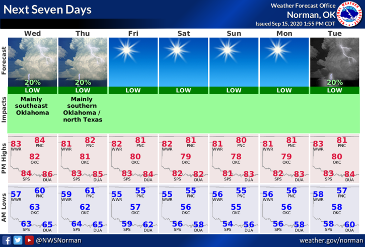
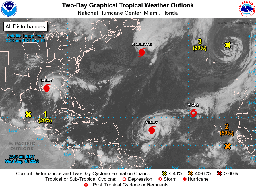
1- As you will see in the graphics below, our weather will remain warm and dry. Mild daytime temps, cool nights will be the norm for about the next week or so. Now, if you plan to travel, a cruise out into the Atlantic wouldn’t be advised. See satellite graphic. If you do plan on traveling, just check in with your nearest NWS WFO.
2- Our next chance for any precipitation appears to be next week. Daytime temps will remain around 80 and overnight temps around 55. Can’t really complain here.
3- If you haven’t downloaded our GARFIELD COUNTY EM app, do so as soon as you can. You will probably need it this winter. This app allows automatic NWS advisories and warnings to come through and we allow the health department to post their info too. It also has a boatload of goo preparedness information. Take the time to play with it and discover it’s benefits. If you don’t have our app, YOU ARE NOT PREPARED!
4- Speaking of preparedness, I will be making a few videos talking about how you can be better prepared for any event. I will probably link these to my YouTube account. I will let you all know when this occurs. Here is your forecast from the NWS/NORMAN;
Wednesday-Partly cloudy. Highs in the lower 80s. Light and variable winds.
Wednesday Night-Mostly clear. Lows around 60. Light and variable winds.
HAVE A GOOD DAY!!
MIKE