0400L-THURSDAY OUTLOOK & INFO FROM GARFIELD COUNTY EMERGENCY MANAGEMENT-9/19/19.
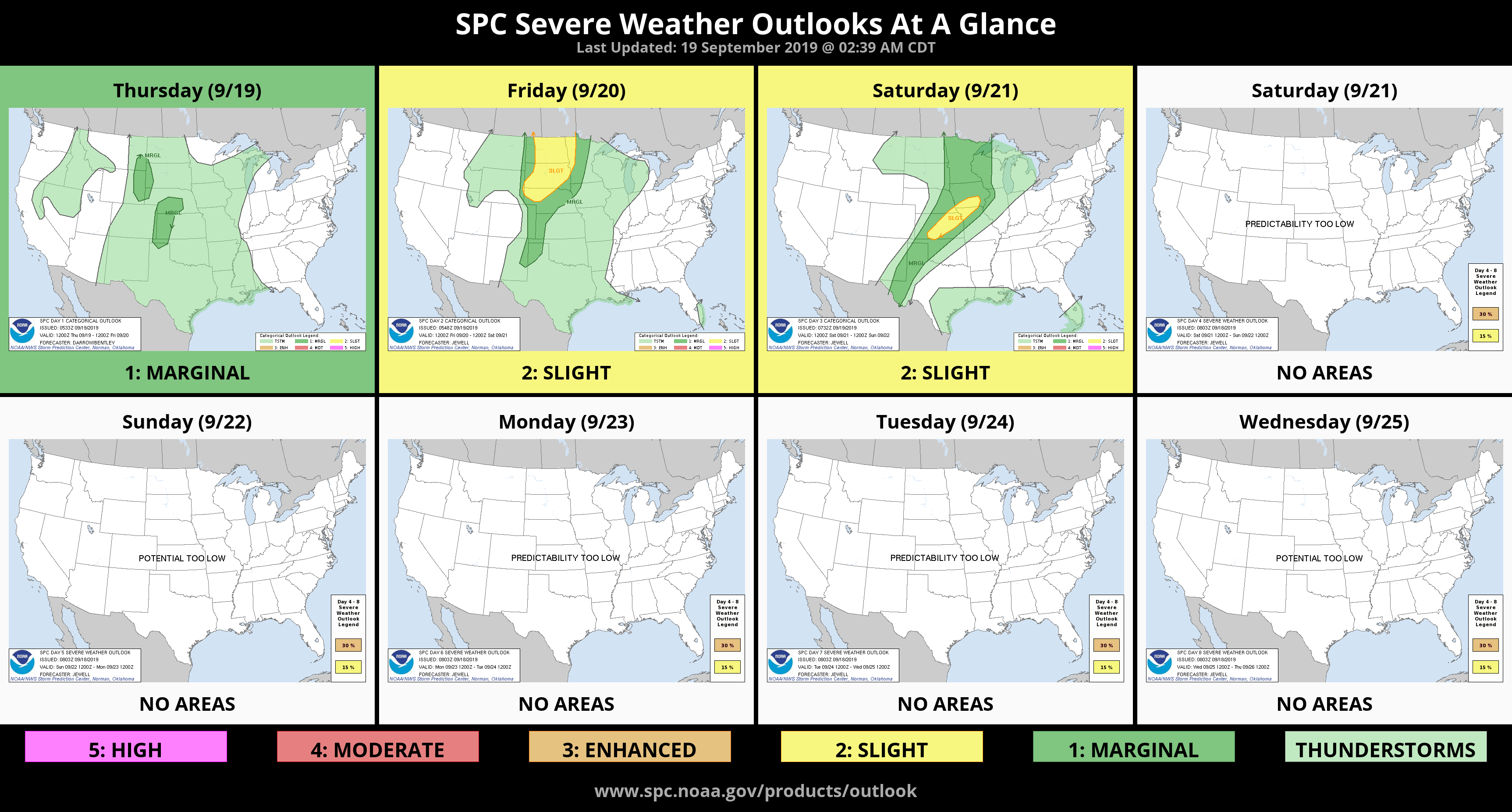
1- GENERAL RISK for thunderstorms later today. This will be hit or miss and most likely later tonight. We’ll see what develops.
2- Over the weekend, there will be a chance for thunderstorms. Some may be severe with winds being the main threat. Torrential rainfall will also be an issue. Again, we’ll wait and see how this mess comes together. Models are not in total agreement per guidance so just be prepared for rain, off and on for the next 5 days or so.
3- TEXTING AND DRIVING is illegal. Twice yesterday the center-line was breached by oncoming traffic due to your phone being more important than paying attention to your driving. There are major ramifications to you if you ever hit me OR anyone else for that matter. Just something to think about.
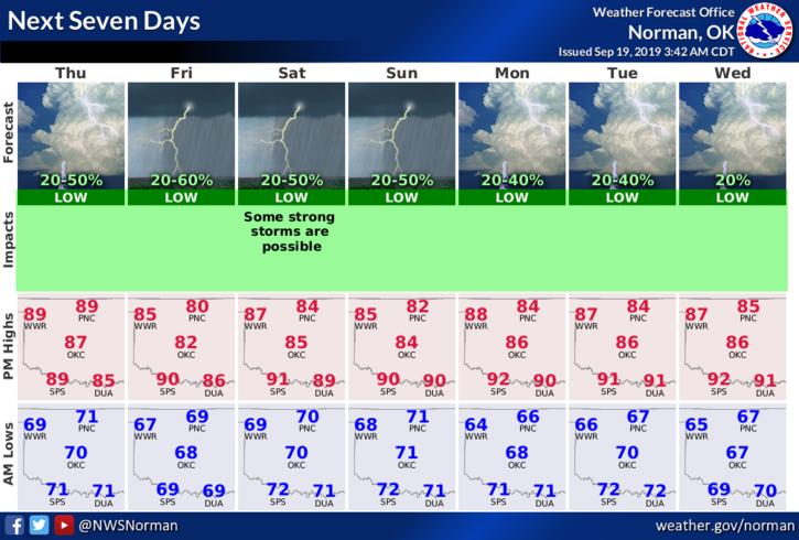
4- Here is your forecast from the NWS/NORMAN;
Today- Partly cloudy. Highs in the upper 80’s. Southeast winds up to 10 mph increasing to 10 to 15 mph in the afternoon.
Tonight- Partly cloudy. Lows in the upper 60’s. Southeast winds around 10 mph in the evening becoming light and variable.
HAVE A GOOD DAY!!
MIKE