0400L-FRIDAY OUTLOOK FROM GARFIELD COUNTY EMERGENCY MANAGEMENT-9/20/19
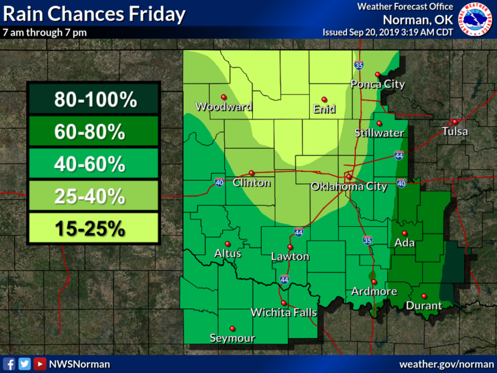
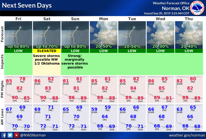
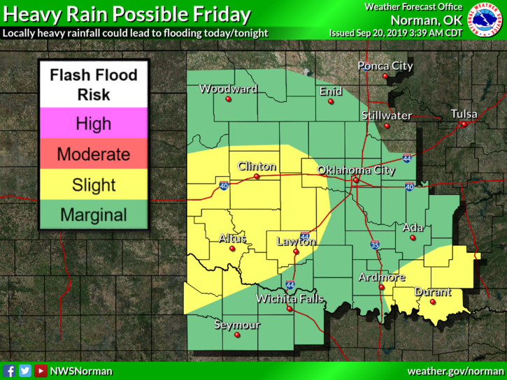
1- There is a 15-25% “GENERAL” thunderstorm risk today. If storms occur, wind, hail, and torrential rainfall would be the main threats. The heavy rainfall issue could cause localized flooding so if storms occur, watch out in low lying areas. We’ll be in a MARGINAL risk over the weekend.
2- It was brought to my attention yesterday that some folks feel I am in the panic mode when I type in “CAPS.” Caps = panic, CAPS=yelling are BOTH NOT correct. When I type in CAPITAL LETTERS, PAY ATTENTION!! I am not one to panic but like most humans I do get concerned. Unlike the TV stations that are ratings based, I am in the PUBLIC SAFETY business and my job is to put out information calmly so you can read it or listen to it and make good decisions, NOT panicked or emotional decisions which could be a bad thing. Preparedness also means to make good, informed, and fact based decisions in a chaotic situation. Folks can’t make good decisions when some TV folks are trying to pull a tornado out of a raindrop. Just sayin…
3- Overall, we’ll be ok. Storms may happen and when they do occur, we’ll put out information based on fact and guidance from the NWS and if needed, OUR SPOTTERS. We’re always ready to respond if needed so hang in there. Download our GARFIELD COUNTY EM app and learn how it works. One day, you will be glad you have it on your phone.
Here is your forecast from the NWS/NORMAN;
Today-Mostly cloudy with a slight chance of thunderstorms. Highs in the lower 80s. Southeast winds around 10 mph. Chance of thunderstorms 20 percent.
Tonight-Mostly cloudy with a chance of thunderstorms. Lows around 70. South winds 10 to 15 mph. Chance of thunderstorms 40 percent.
HAVE A SUPER DAY!!
MIKE