0315L-THURSDAY OUTLOOK FROM GARFIELD COUNTY EMERGENCY MANAGEMENT-9/2/21
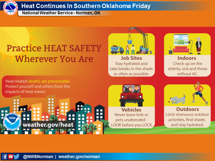
1-Another hot & humid day but this time with wind. Heat index temps will be in the low 100s and wind gusts are forecast to be around 25 mph. At least we’ll have a cooling factor in the wind.
2- Rain chances increase tonight after midnight through Friday and Saturday and possibly into Sunday. Chances are less than 50% but right now but we’ll take it. We are very dry so be careful utilizing anything related to fire. Overall, we’ll be ok so here is your forecast from the NWS/NORMAN;
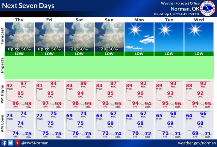
Thursday-Mostly sunny and hot, with a high near 97. Heat index values as high as 103. South wind 6 to 16 mph, with gusts as high as 25 mph.
Thursday Night-40 percent chance of showers and thunderstorms after 1am. Partly cloudy, with a low around 72. South wind 10 to 15 mph with gusts as high as 20 mph.
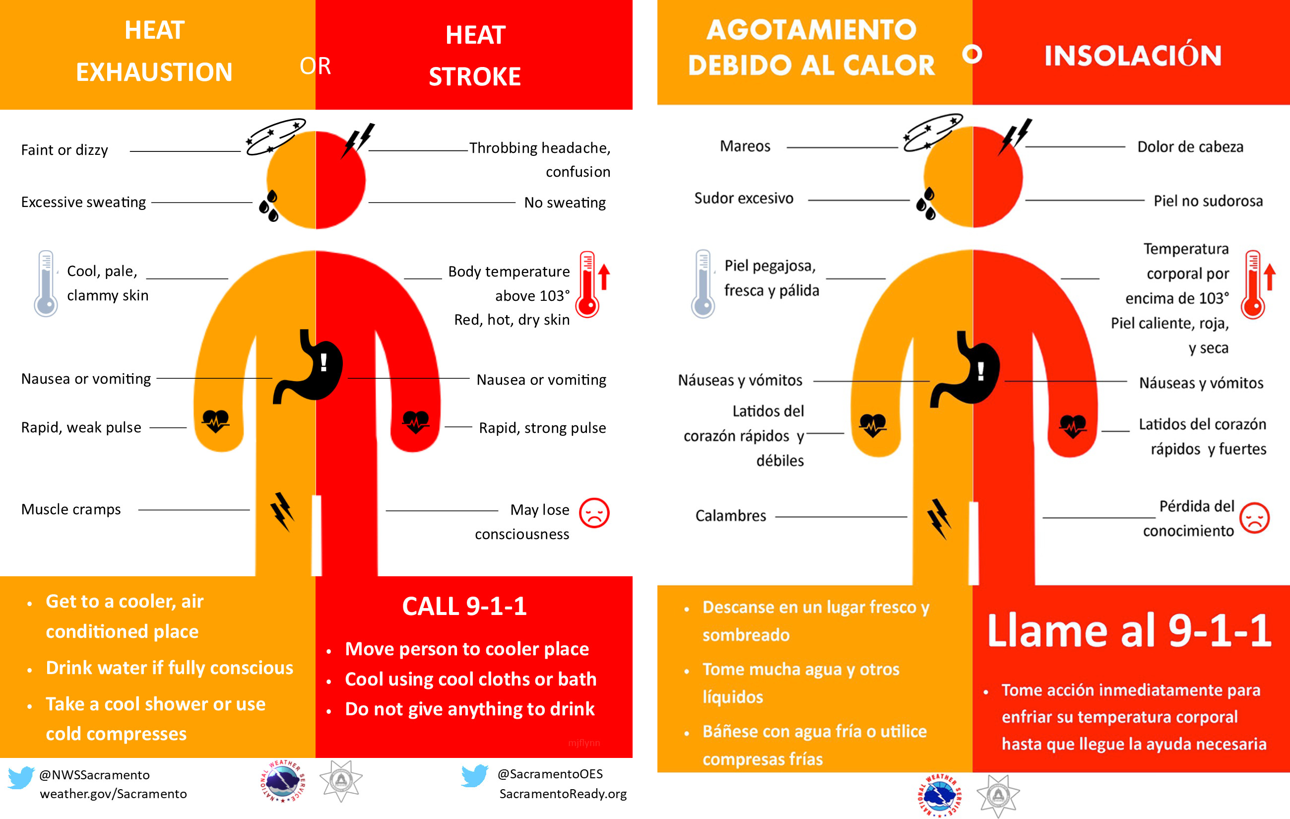
FINALLY: With sports activities in full swing this fall, make sure your kids stay hydrated and understand why this is important. Believe it or not, their lives could depend on this.
HAVE A GOOD DAY!!
MIKE